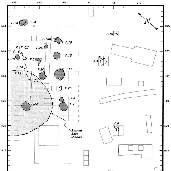
TBH Teachers: Coordinate Grid: Mapping an Archeological Site

Download lesson plan and included materials
Subject: Mathematics
Grade: 4th grade
Author: Carol Schlenk, revised by Mary Rodriguez (2023)
Time Duration: One 45-minute class period
Overview: Archeologists preserve the context of a site through the use of a rectangular grid or Cartesian coordinate system. Coordinate grids are reflexive frames that extend infinitely in two or more directions from zero. This lesson focuses primarily on distance and pacing, and secondarily on coordinate grids. This activity is intended to help students develop a sense of distance. Students will pace off distances, estimate distances and use reasonable numbers.
TEKS: Mathematics, Grade 4
- (1A), apply mathematics to problems arising in everyday life, society, and the workplace
- (6A), apply knowledge of right angles to identify acute, right, and obtuse triangles
- (8B), convert measurements within the same measurement system, customary or metric, from a smaller unit into a larger unit or a larger into a smaller unit when given other equivalent measures represented in a table
- (8C), solver problems that deal with measurement of length, intervals of time, liquid volumes, mass, money using addition, subtraction, multiplication, or division as appropriate
Materials:
- Grid paper (included)
- Teacher’s pace list (included)
- Pencils
- Measuring tape
- Rulers (optional)
Activities and Procedures:
Step 1: Ask children how they might calculate the length of the playground. Tell them about the ability to calculate distance using a pacing technique (for example, one of my paces is two feet in length)
Step 2: Go to the playground and have them figure their pace for 10 yards (or use meters, as most archeologists do). To do this, lay out a tape measure that is 10 yards or meters long. Line up the students and have them walk the length of the tape measure, and ask them to count how many steps they take.
Step 3: Record on the chart below the length of their paces. To do this, divide 10 meters/yards by the number of steps to calculate the average length of step for a given student (for example, if a student takes 15 steps over 10 meters, they have a pace of 0.66 meters).
Step 4: Have them figure the length and width of their playground by pacing it (counting their steps and multiplying the number of steps by the length of their steps). Have each student map the playground on a piece of grid paper. You will need to set a scale based on the size of the playground (for example, one square of the paper could equal one foot, or one meter). Rulers can be used to complete the mapping activity.
Closure: Archeologists preserve the context of a site by mapping it on a Cartesian coordinate system. Lead students to understand why pacing is an important tool for the initial mapping of a site by discussing site recording.
Extension Activities: Use these same numbers to begin a lesson on area. Or, create a site on the playground by planting artifacts. The students can then grid the playground and map the artifacts.
Student Product: A map of the playground