 |
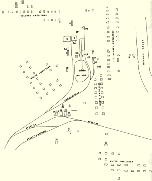 |
A 1911 map
of the Aldridge sawmill and community, prepared for lumberman
J.H. Kirby, was used by USDA Forest Service archeologists
investigating the site to help identify features and foundations.
The map denotes the segregated sections where dwellings
for "colored" and white residents were located
as well as the various mill and town structures.