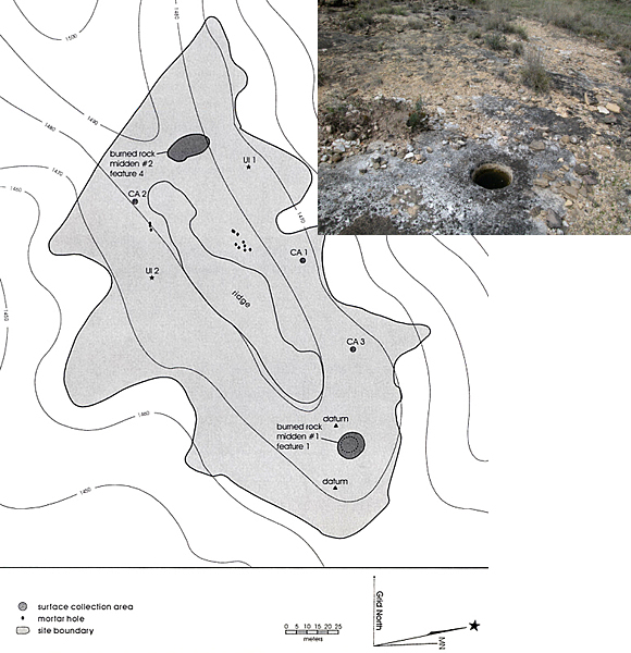
Map showing location of
12 bedrock mortar holes (denoted with diamond symbols) and two burned rock
middens at site 41BR228. Located on a saddleback ridge at an elevation of
about 1,480 feet, the site is extensive and located some 500 m north of
an intermittent tributary of the small Devils River. Map by CAR-UTSA.