|
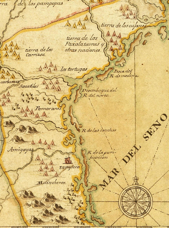
| Indian villages, or rancherías, are shown dotting the landscape near the Rio Grande delta and up the coast in this ca. 1720s map by Alvarez Barreiro. Although the Spanish encountered numerous Native groups in much earlier expeditions, no group names were recorded until well into the 18th century. Finished and first published in 1728, this map is best known from the 1770 copy shown here. Original in the British Library. Map image: Copyright © The British Library; All Rights Reserved; Additional MS. 17,650.b |