|
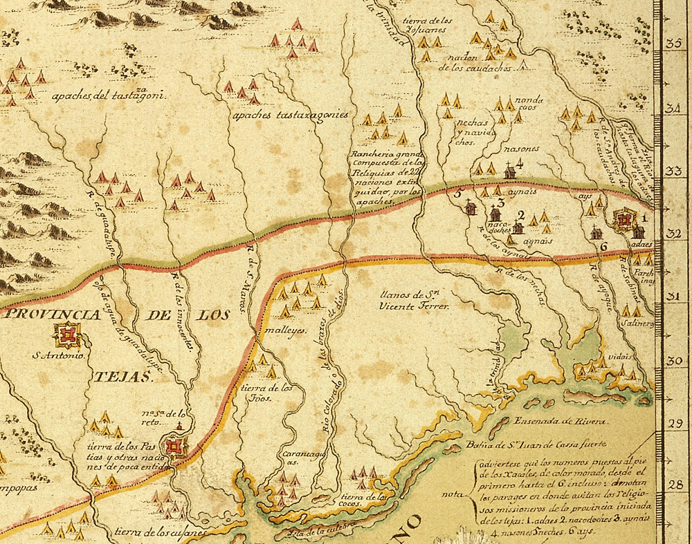
| Portion of a later version of a 1728 Spanish map, one of the first maps to show the location of Mission Dolores – the mission symbol (structure topped by cross) numbered “6.” Note the nearby Indian camp symbols (tepee) labeled “ays,” referring to the Ais Indians. Not far to the east (right) is Los Adaes, marked by both presidio and mission symbols. This map was the work of Álvarez Barreiro, a military engineer and a trained mapmaker charged with compiling a series of maps documenting northern New Spain. In 1726-1727 he accompanied Brigadier Pedro de Rivera on an official inspection of the presidios and missions of the Province of Texas. The resulting map is based on considerable first-hand knowledge and is said to have been highly valued for its completeness by the Spanish king. Finished and first published in 1728, this map is best known from the 1770 copy shown here. Original in the British Library. Map image: Copyright © The British Library; All Rights Reserved; Additional MS. 17,650.b. |