|
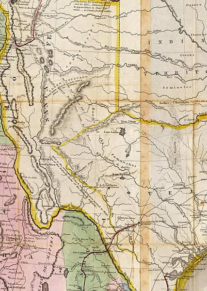
| An 1847 map of Mexico and Texas shows what were thought to be the boundaries of Texas prior to the end of the Mexican War as well as the range and locations of various Indian goups across the region. Known as the "Treaty Map," it was used as "the official cartographic reference in negotiating the peace treaty of February 2, 1848, which terminated the Mexican war… ." For full map view and to zoom in on detail, see the David Rumsey Map Collection (http://www.davidrumsey.com/), Mapa de los Estados Unidos de Mejico published in 1847 by John Disturnell, New York. |