|
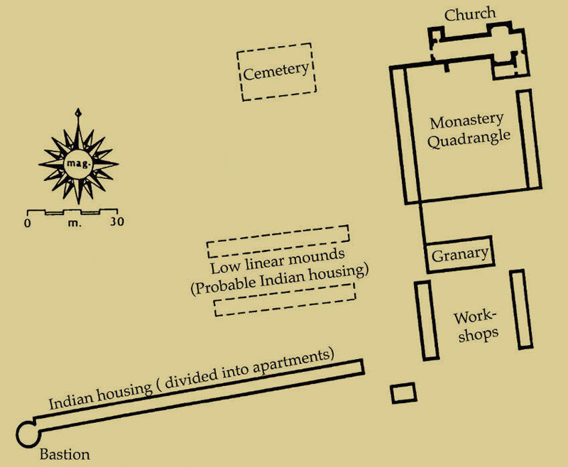
| Map of Mission San Juan Bautista in its third location (1740) on a hillside west of the presidio site. Archeologists uncovered remains of the probable granary, a well or cistern, the native housing area, and midden (trash) deposits. (Map adapted from Eaton 1989.) |