|
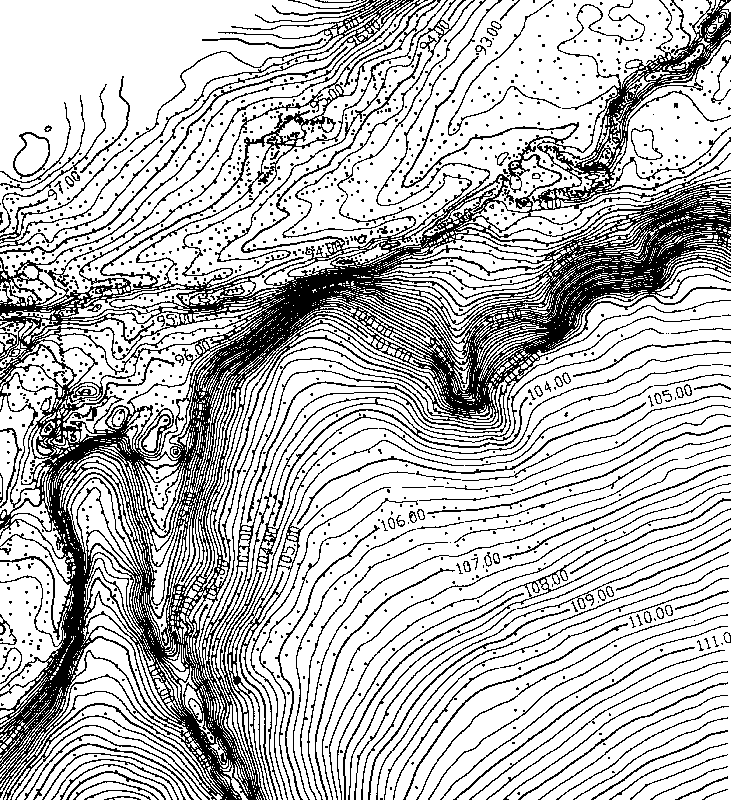
| An example of a highly detailed topographic map in-the-making of an archeological site in a valley. Each of the dots on this raw map represents the location of an elevation shot taken by a total data station. The final publish map will be cleaned up and simplified. Map created by Ken Brown. |