|
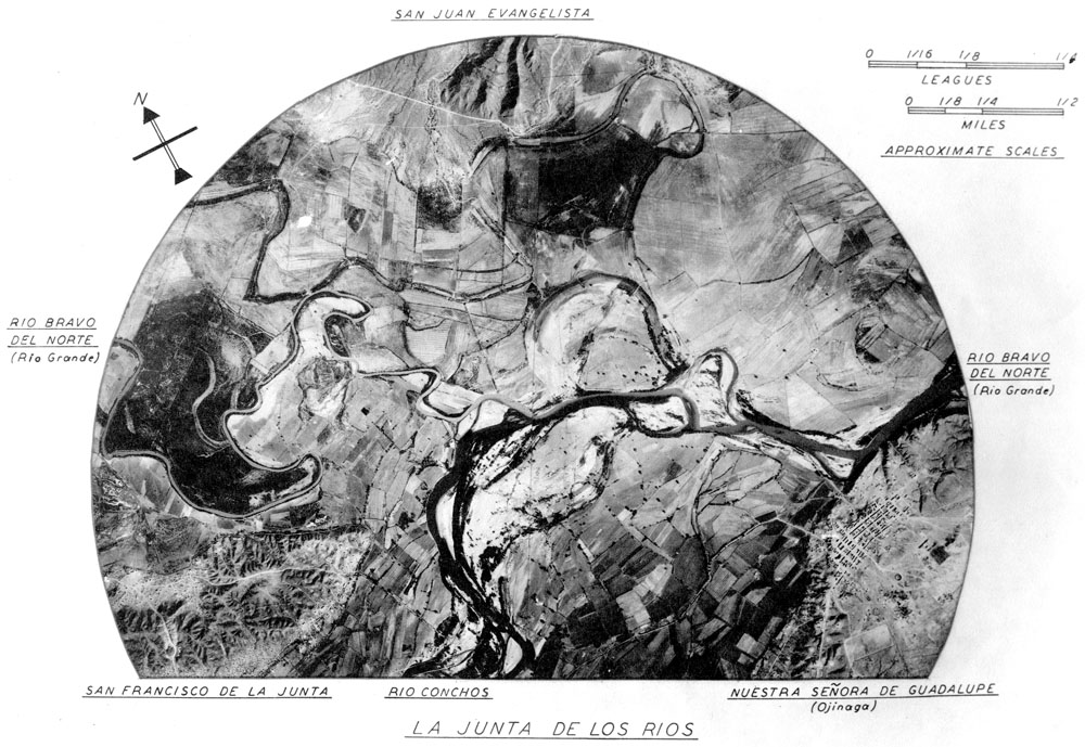
| Aerial photograph of La Junta, the confluence of the Rio Bravo del Norte (Rio Grande) and the Río Conchos showing relative locations of three of the major pueblos as they were known to the Spanish in the colonial era. San Juan Evangelista was on the north side of the Rio Grande, opposite the confluence. San Francisco and Guadalupe (modern Ojinaga) were south of the Rio Grande, the former on the west side of the Río Conchos and latter on the east side. This graphic was created by J. Charles Kelley using an aerial photograph probably taken in the 1940s. It shows the area before most modern agricultural and urban development, hence many of the abandoned former channels of both rivers can still be traced. This complex web of old channels, floodplains, and low marshy areas, explains why productive agriculture was possible at La Junta beginning by around 800 years ago. Center for Big Bend Studies Archive, Sul Ross State University. |