|
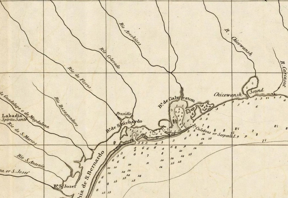
| Detail of 1805 map British cartographer John Arrowsmith showing more detailed knowledge of the upper Texas coast and naming Galveston Bay and showing depth soundings. Although the locations of Indian groups are not shown, the westernmost river emptying into Galveston Bay, the San Jacinto, is labeled "Rio Arookisos" (Akokisas). Source: David Rumsey Map Collection. |