|
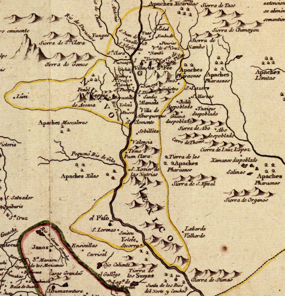
| Map of New Spain, 1768, with New Mexico (including the El Paso valley) encircled in gold and Provincia de los Tejas on right. After the Pueblo Revolt of 1680, a large number of Tigua, Piro, Tompiro, Tano, and Jemez refugees and hostages accompanied the Spanish south to El Paso where Governor Otermín founded the missions of Corpus Christi de la Ysleta, San Antonio de Senecú, and Nuestra Seńora de la Limpia Conceptión del Socorro for them. “Nueva Mapa Geographico de la America Septentrional” was drawn by Mexican cleric and scientist, José Antonio de Alzate y Ramirez. View larger versions. |