|
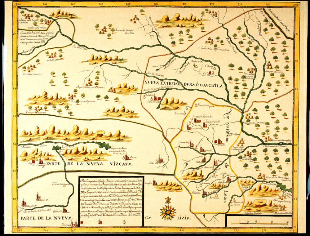
| Inset of map of Coahuila, Nuevo Leon, and Texas in 1729, drawn by Francisco Alvarez Barreiro exemplifies the types of geographical distortions recorded in early depictions of the region, including errors in river drainages such as Pecos and Rio Grande. Image, “Plano corographico de los dos Reynos de Nuevo Estremadua o Coaguila y el Nuevo Leon,” courtesy of the Center for American History, University of Texas at Austin (JBP 42,1729). |