|
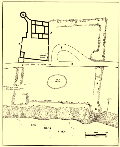
| Map of the Presidio San Sabá as it looks today. Note the Country Club Road that bisects the original presidio and the golf green that lies in its southern portion. The bold portion in the upper-left corner represents the portion of the presidio reconstructed in the 1930s. Drawing by James Ivey from La Tierra 1981 8(4). Courtesy of the Southern Texas Archaeological Association. |