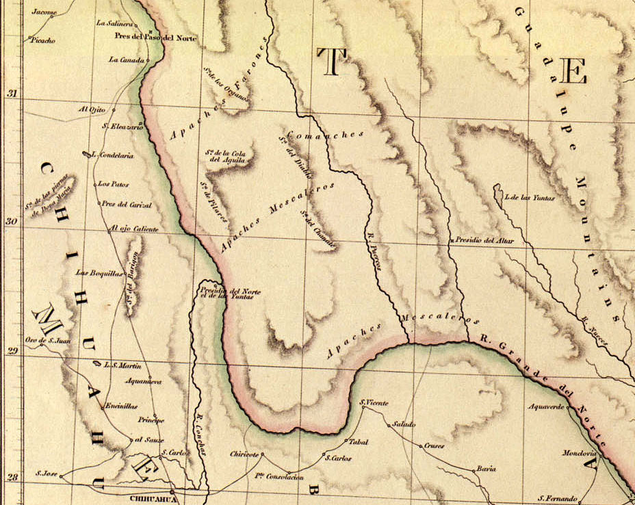
English map publisher John Arrowsmith’s 1841 map of the Republic of Texas is one of the first maps showing that the new republic’s territory extended west and southward to the Rio Grande in western Texas. The map also shows the areas then dominated by key Indian nations, namely the Apaches Mescaleros, Apaches Farones and the Comanches. Map Source: Contours of Discovery, 1982, Texas State Historical Association.