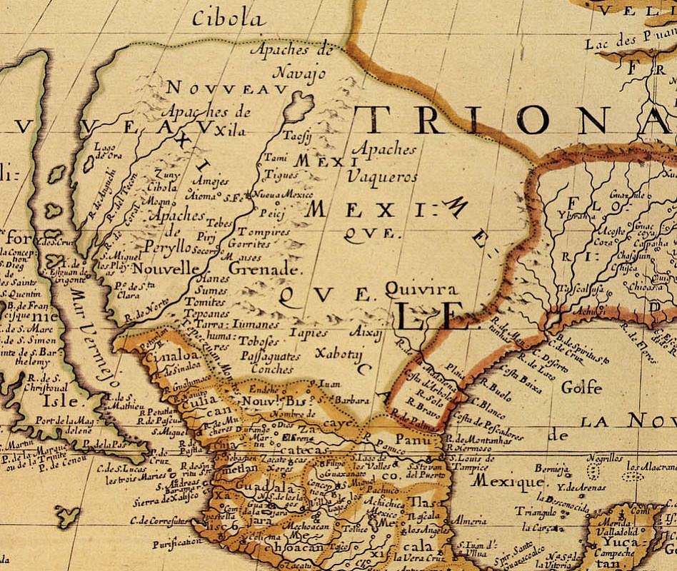
This 1650 French map drawn by the outstanding cartographer Nicolas Sanson d’Abbeville shows how little was known about the geography of western North America at the time. The R. de Norte (Rio Grande) is shown draining into the Gulf of California. The Trans-Pecos is terra incognito although the French did know the names of some of the Indian groups encountered by the Spanish including the Sumas, Passaguates, Tobofes, and Iumanes (Jumanos). Map Source: Contours of Discovery, 1982, Texas State Historical Association.