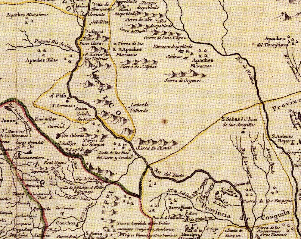
Greater Trans-Pecos portion of 1768 map by José Antonio de Alzate y Ramírez, a Mexican-born cleric and leading scientist educated at the best academies of New Spain. He created maps from records kept in the archives of Mexico, explorers' descriptions, and other maps of the day. This map is fairly accurately for the day and reflects the fact that most of the Trans-Pecos remained terra incognito. For orientation, follow the Rio Grande (“Rio del Norte”), which the Spanish knew well by the 18th century. As the map shows, the Spanish had a sustained presence in northern Mexico and New Mexico. The only settlements shown within the Trans-Pecos were those at ”Junta de los Rios del Norte y Conchos” and “el Pàso” where presidos (larger dark circles with flags), and named missions and villages (smaller circles and house symbols) were located. The most prominent Indian group depicted in the region is “los Sumas,” although other nations are shown in northern Mexico and Apaches are shown in many places to the north.