The Clear Fork of the Brazos. Travelers
between Fort Griffin and Fort Richardson crossed this
wide, shallow stretch of the river below the town called, "The Flat."
Photo by Susan Dial.
Click images to enlarge
|
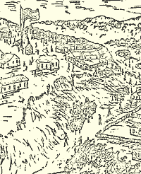
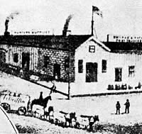
Sketch of Fort Griffin overlooking the town known as The
Flat below. Sketch circa 1876, courtesy Texas Parks and
Wildlife: Harlan, 1969. |

The post bakery at Fort Griffin after
renovation. Because bread was one of the staples of
the soldiers' mess, hundreds of loaves of bread per
week were produced in the bakery's brick ovens. Photo by Susan Dial.
|

The last standing reminder of the frontier town known
as The Flat, the Masonic Lodge maintains a lonely presence
among motts of mesquite and hackberry. Photo by Susan Dial. |
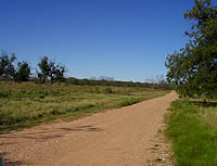
Griffin Avenue. What was once a bustling
main street through The Flat is now a county road cutting
through the Brazos River bottom land. A few remnants
of stone foundations and scatters of patinated glass
and ceramics are all that remain of the nineteenth-century
boom town frequented by such frontier notables as Doc
Holiday, Wyatt Earp, Lottie Deno, and John Wesley Hardin.
Photo by Susan Dial.
|
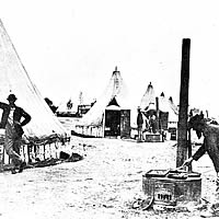
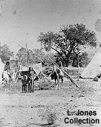
Tent scene in the 1860s. The tall circular tents with
vertical posts as base were known as canvas picket cottages,
many of which were used at Fort Grffin for lack of more-permanent
housing. |
|
The U.S. Army's forts on the northwestern frontier
of Texas were bound tightly to the ebb and flow of warfare
with the Plains Indians. As each post outlived its purpose
and was abandoned, civilians who had congregated nearby faced
an uncertain future. Fort Griffin in its heyday spawned one
of the liveliest and most notorious settlements in the West.
The fort was the longest continuously-occupied post in the
region, but the town that took its name barely survived the
Army's departure in 1881.
The post that became Fort Griffin was established
in the summer of 1867 by companies of the 6th Cavalry. The
original site was in the bottoms of the Clear Fork of the
Brazos River, a few miles downstream from the 1850s site of
Camp Cooper. It was originally named Camp Wilson, for a recently
deceased 6th Cavalry lieutenant, Henry Wilson. In 1868, it
was renamed Fort Griffin, in honor of Colonel Charles Griffin,
the departmental commandant who had himself recently died.
More than just a name change was involved, however, as the
post was moved away from the unhealthful bottoms to an adjacent
plateau.
In later years, the location would be called
"Government Hill" by some local residents. To the
west, Collins Creek flowed around the base of the hill into
the Clear Fork, and the creek served as the fort's water source
for a time. A stronger stream east of the plateau furnished
a location for a sawmill, and would be named "Mill Creek."
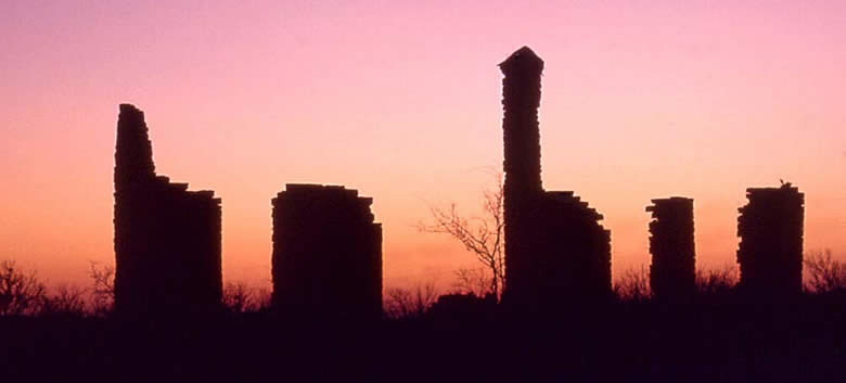
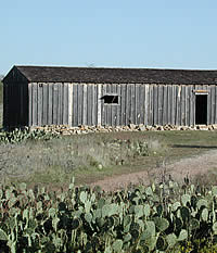
The scant architectural remains of both the
fort and town belie the brief, but significant, life of each.
The fort's bakery and powder magazine have been restored,
and partial walls of the administration building and sutler's
(post trader's) store still stand, along with a chimney from
one of the officers' quarters. Foundations of numerous other
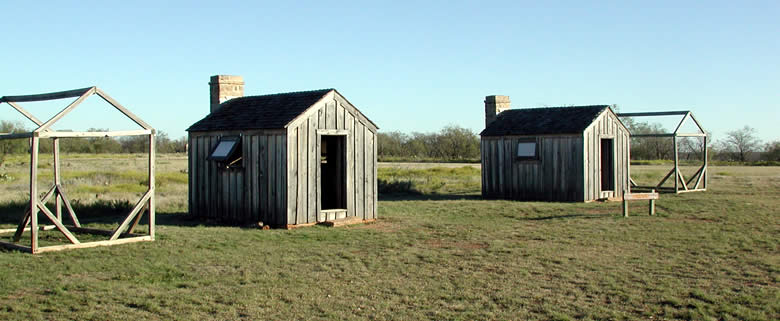
buildings are visible on the grounds. Reconstructed frame
buildings represent the size and style of enlisted quarters
and mess.
Even less remains of the town below the hill,
known primarily as "The Flat," but also as "Buffalo
Town, "Fort Griffin," and, simply, "Griffin."
The townsite is on private property, but is accessible by
county roads. Its sole surviving building is its first all-stone
structure, the Masonic lodge and school house, built in 1878
and restored by the current owner. Foundations of other buildings
are visible, and a number of them flank the current county
road running from the base of Government Hill to the place
where the old Fort Richardson road crossed the Clear Fork.
This road was "Griffin Avenue," the main street
of the town, in the late 1870s.
As a military establishment, Fort Griffin was
something of an afterthought of the Army throughout the life
of the post. Plans for substantial permanent structures were
drawn and approved, but most were never consummated. The Army
had to request funds from the U.S. Congress for building materials,
transportation, and skilled labor for each of its significant
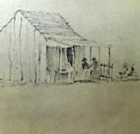
construction projects. In the meantime, temporary quarters
were built from whatever local materials could be obtained,
by enlisted personnel with whatever time and skills were available
among them.
The Army high command never could quite get
around to Fort Griffin, so local commanders made do with what
they could cobble together. For the most part, that was "rawhide"
lumber—so named because of its similarity to untanned,
or "green," cattle and buffalo hides—milled
at the nearby stream and fashioned into barracks and other
buildings by whatever infantry companies were not on campaign.
Foundations were chiseled from local limestone, possibly quarried
from the base of the hill or hauled from nearby streambeds.
But the rawhide lumber shrank and warped as
it dried, so that the wood was little better than mesquite
brush as a defense against wind and rain. A favored alternative
was "picket" construction—straight oak, pecan,
and elm trunks and limbs set on end in shallow trenches and
chinked with cattails, brush, rock, and mud. The alternative
for many enlisted personnel was long-term use of the Army's
short-term shelter, the canvas tent.
|
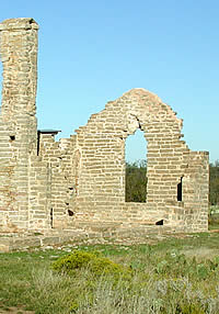
The administration building was the
"nerve center" of a frontier army fort, the
place where orders would be issued and received. Photo
by Lester Galbreath.
.
|
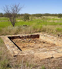
Stone foundation of one of the sergeant's quarters. Constructed
of wood, the building, like many of the other frame structures
at the post, did not survive. Photo by Susan Dial. |
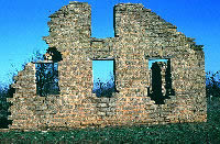
Sutler's Store. The post sutler was
licensed by the Army to sell merchandise to soldiers.
The store served much the same function as the post
exchange of the modern Army. Photo by Lester Galbreath.
|
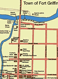
History on every corner. The map
of the short-lived but colorful town known as Fort Griffin
or The Flat evokes tales of the gamblers, outlaws, buffalo
hunters,cowboys, and prostitutes who at one time crowded
the dusty streets. Adapted from map reconstruction by
Lester Galbreath.
|
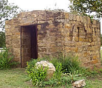
Temporary home to outlaws, drunks, and scoundrels, the
jail at The Flat now stands overgrown at its new site
in the town of Albany. Photo by Susan Dial. |
| Impressive or not,
Fort Griffin was to become a major base for the campaigns
that would finish the Comanche and Kiowa as a threat to
settlements on the northwestern frontier. |
|
