Small, mobile bands of hunting and gathering peoples repeatedly visited this rockshelter and terrace site near the mouth of the Pecos River in the arid Lower Pecos Canyonlands in southwestern Texas for at least 10,000 years. Layer upon layer of evidence tells us that from about 9000 B.C. until A.D. 1000, generation after generation visited this spot where a convenient southeast-facing overhang provided afternoon respite from the hot desert sun. The river terrace in front of the shelter had room to spread out and gave easy access to the cooling waters of the Pecos River.
People kept coming back to Arenosa Shelter (41VV99) to take advantage of the ready access to the varied plant and animal resources of the deeply incised canyons and those of the river itself. Less than a mile downstream was the even larger Rio Grande, an easy trek along the broad river terraces. They regularly fished the rivers, filleted the catch, and doubtlessly dried the meat in front of the shelter, thus creating a valuable commodity—dried protein that could be transported near and far. They used the bones from the fish and the animals they hunted and trapped to make tools and ornaments, and made chipped stone and groundstone tools from the cobbles that lined the river. And it wasn't all mundane, they painted symbols on river pebbles and skinned small carnivores for their pelts, carefully retaining facial characteristics, probably to create paraphernalia used in sacred rituals. The record of all of these activities and more has been preserved in the exquisite stratigraphy of Arenosa.
Vulnerable to the rare, but often catastrophic, major floods of the Pecos and Rio Grande Rivers, Arenosa was periodically inundated with floodwaters for more than 11,000 years. The waters quickly retreated, but often left behind a fresh layer of sandy silt across the terrace and on the floor of the rockshelter. Some severe floods, particularly early in the site's history were powerful enough to sweep away or truncate existing layers, sometimes leaving a layer of winnowed lag deposits at the bottom of thick "upwardly fining" flood deposits. Between floods, people lived on many of these flood-deposit surfaces, covering them with charcoal, burned rock, mussel shell, animal bone, broken tools, and other cultural materials. These living surfaces were eventually covered with more flood deposits, creating a textbook example of archeological and geologic stratification (layering) that eventually amounted to over 42 feet (12.8 meters) thick.
Under the direction of David S. Dibble (see Bonfire exhibit biographic sketch), archeologists from the Texas Archeological Salvage Project (TASP) at the University of Texas began excavating Arenosa Shelter in 1965. They dug by following the natural stratigraphy and �peeling off� each layer one by one. The work was part of a multiyear project to carry out archeological and environmental research in the area that was to be flooded by the proposed Diablo Reservoir (renamed Amistad Reservoir—see Before Amistad to learn more).
After three seasons of work at Arenosa, the crew had exposed a series of deposits 42 feet tall that consisted of 49 identifiable layers, about half of which contained cultural materials. Over a half a million items were catalogued from the site, including about 16,000 stone tools, over 300,000 pieces of debitage, and over 47,000 pieces of animal bone. Of the stone artifacts, over 2000 were identified as projectile points, 141 as painted pebbles, and 121 as groundstone. Some 1,000 pieces of bone were identified as artifacts, including about 500 awls and 200 beads identified on the basis of form. The Arenosa collection is part of the museum collection from Amistad National Recreation Area that is curated and managed at TARL under a long-term cooperative agreement. The cataloging of the last portions of this massive artifact collection was completed in 2008.
Regrettably, full analysis and comprehensive reporting on the Arenosa work has yet to be accomplished. Researchers have succeeded in analyzing some of the material the site yielded in the four decades since the excavations ended. The three most extensive studies were Ph.D. dissertations by Michael B. Collins in 1974, Peter C. Patton in 1977, and Christopher J. Jurgens in 2005. Collins studied Arenosa�s patterned distribution of lithic artifacts and the debris from their manufacture. Patton analyzed the site's stratigraphy from a geological perspective and reconstructed the history of flooding for the Pecos River and other locales. Jurgens analyzed a large sample of the site�s animal bones and reconstructed the many ways that animals were used. The work of these researchers has done much to further our understanding of how the prehistoric people of Arenosa lived, but there is still much to be learned from the records and collections amassed during the 1960s excavations.
In This Exhibit
The Setting section explains how the site was formed by an alternating series of floods and human occupations.
Investigations chronicles the history of the 1960s excavations and summarizes the 40-year history of research that has been done on Arenosa materials since excavations ended.
Explore Arenosa is an interactive map that allows readers to explore the site through images of the excavation and stratigraphic profiles, and learn about its features.
Arenosa Through Time is an interactive profile linked to summaries of the cultural materials found within each of the major zones and outlines how life changed for the prehistoric people who visited Arenosa through time. Sidebars discuss the site�s stratigraphy and its radiocarbon dates, and provide detailed supplemental tables for serious students of archeology.
Half-Told Story highlights the most important results that have been published to date and discusses the great potential that the Arenosa collections and records hold for future research.
Credits & Sources acknowledges those who created this exhibit and provides a bibliography listing virtually all of the published sources that can be consulted to learn more about the site.
|

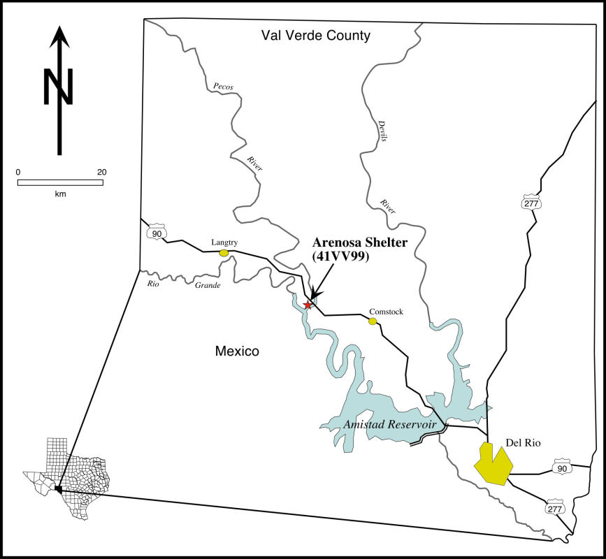
Arenosa is located in the Amistad area of the Lower Pecos region of Texas—
a semi-arid limestone plateau that is deeply dissected by the Rio Grande, Pecos, and Devils rivers and their tributaries. Jurgens 2005, Fig. 2.
Enlarge to see full map.  |

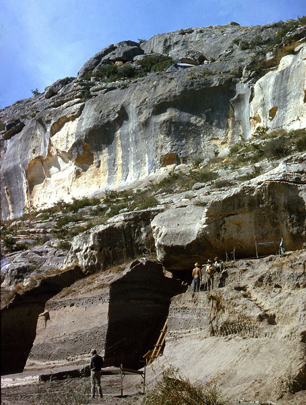
Arenosa excavations in 1965, when only the upper deposits had yet been exposed. ANRA-NPS Archives at TARL.  |

Dave Dibble records his daily field notes. ANRA-NPS Archives at TARL.  |
| Our progress of late is rather slow and routine as we peel these blocks down stratum by stratum. Slowly, however, I feel that we are documenting a mass of highly significant stratigraphic as well as ecological data. Virtually all the cultural strata are yielding food remains and our sampling of such items as shell and bone has been massive. The analysis of this stuff is going to be a hellish job for someone. � Dave Dibble, November 19, 1965 |

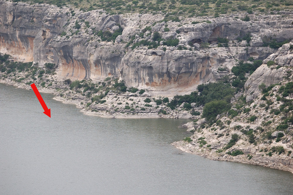
Arenosa as it appears today, inundated by the waters of the Amistad Reservoir. July, 2007 photo by Chris Jurgens.  |
|