Setting
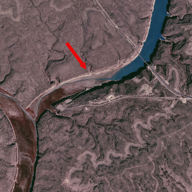
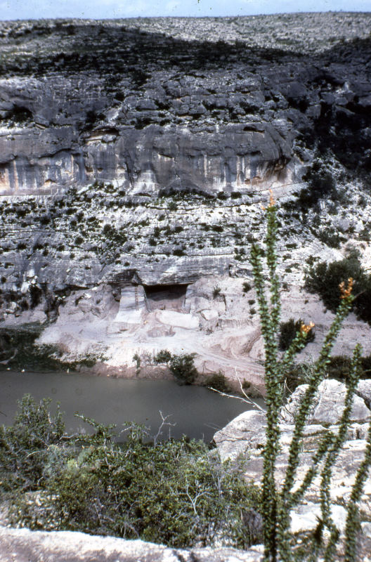
Arenosa as it appeared in the mid-1960s before the creation of the Amistad Reservoir. The site is situated on the northwest bank of the Pecos River, about three quarters of a mile above its confluence with the Rio Grande. ANRA-NPS Archives at TARL. |
|
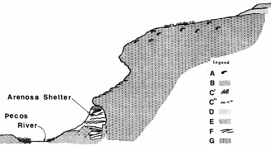
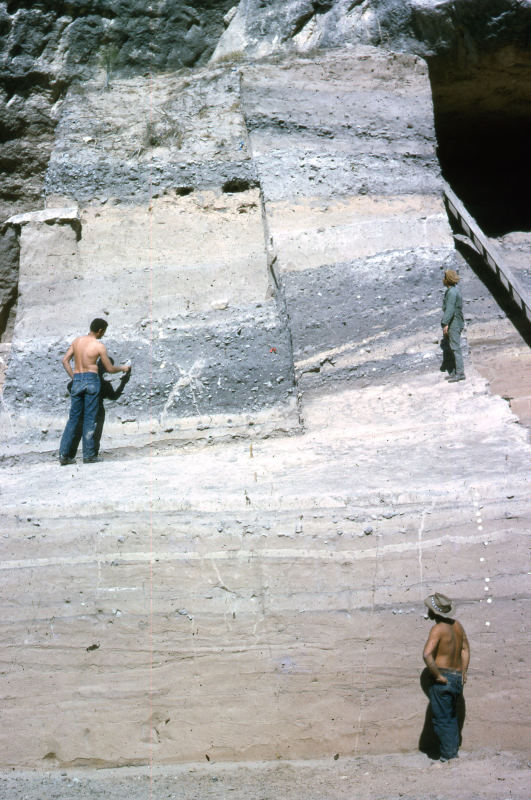
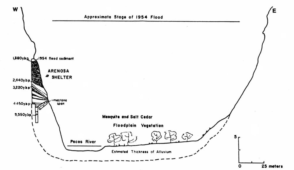
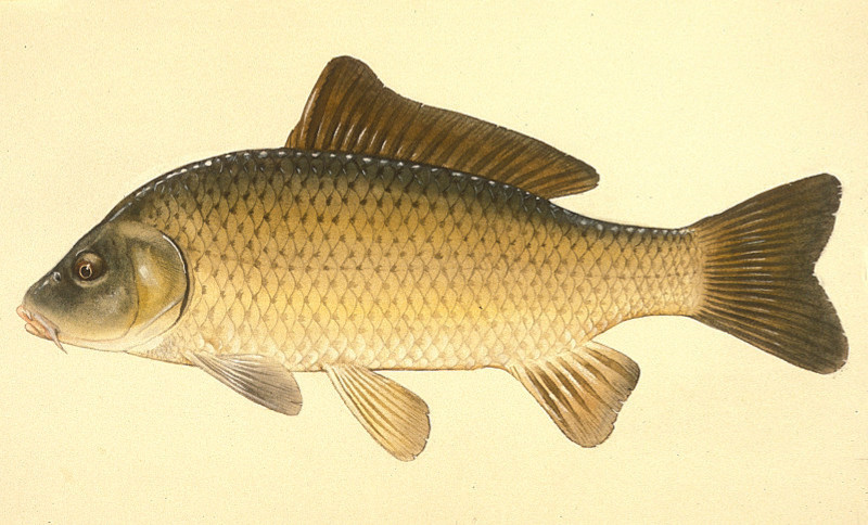
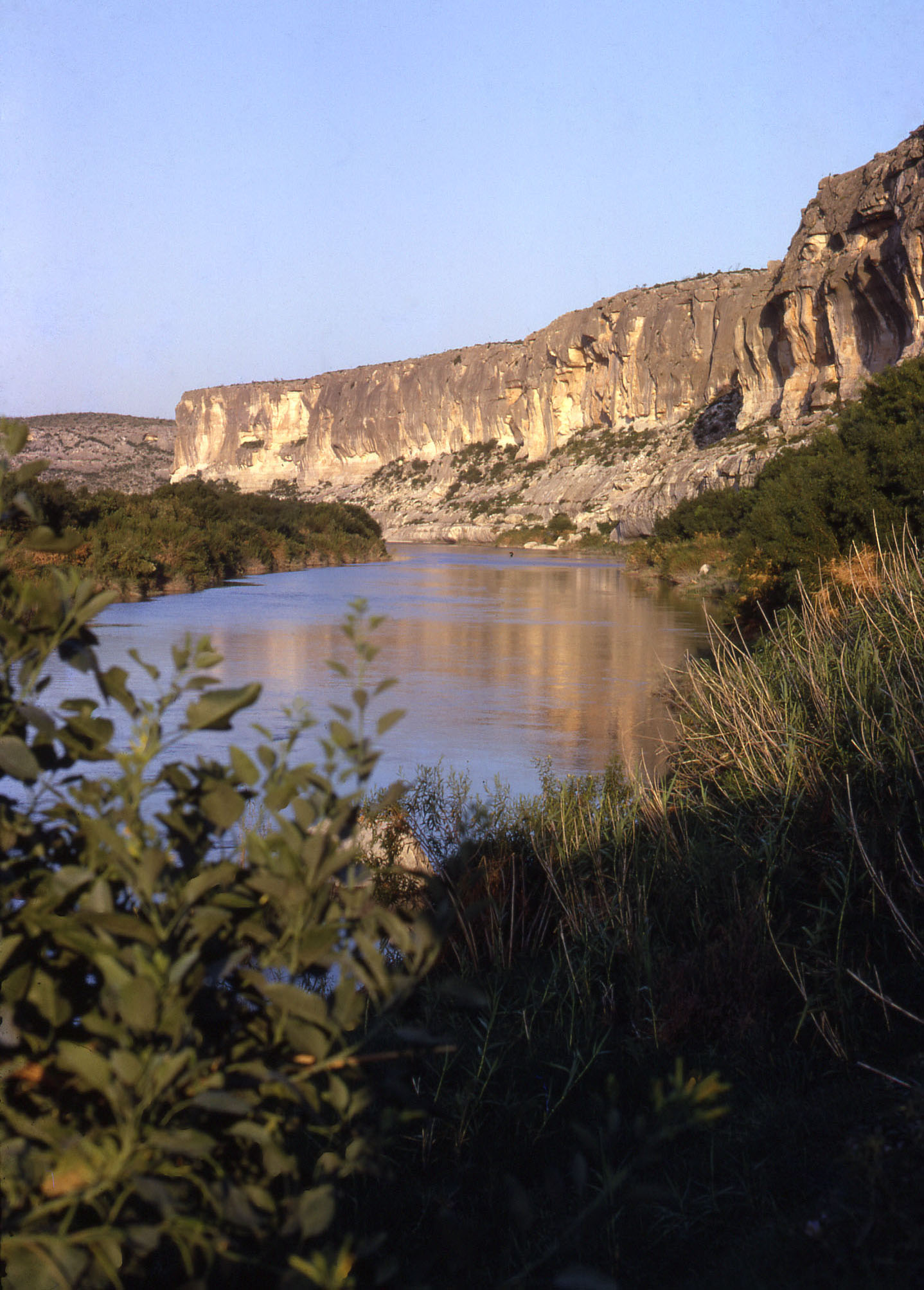
Arenosa Shelter lies in the heart of the Lower Pecos Canyonlands—a craggy, deeply dissected limestone landscape formed over geologic time by the Rio Grande, Pecos, and Devils Rivers. These three rivers and their tributaries have sustained plant, animal, and human life in the Amistad area for millennia, but they also have the capacity to destroy life in catastrophic floods surging through the canyons. The deep alluvial deposits within Arenosa Shelter revealed a record of these floods and of the intervening episodes of human occupation spanning more than 11,000 years. The Lower Pecos Canyonlands region is on the northeastern edge of the Chihuahuan Desert and has a climate that is classified as semi-arid. The average annual temperature is 70°F, ranging from an average low of 51°F in January to an average high of 86°F in July. It receives an average of 18 inches of rain a year, mainly in the spring and fall when thunderstorms roll through the region. The heaviest downpours come from tropical storms that occasionally stall over the area, dumping enough rain to fill the canyons in a matter of days, or even hours. Droughts lasting for months, years, and even decades often leave the region ill-prepared to withstand severe floods without major losses of soil, rock, and vegetation. Arenosa Shelter's deposits preserve an unparalleled record of these tremendous floods. The site is situated on the northwest bank of the Pecos River, about three quarters of a mile from its confluence with the Rio Grande. Before the creation of the Amistad Reservoir, the final few miles of the Pecos meandered across a 600-foot wide floodplain bounded by nearly vertical cliffs towering 350 feet tall. Thick alluvial deposits blanketed both sides of the river, and had completely filled the rockshelter at the time of its discovery. Catastrophic floods giveth and they taketh away. What happens at any one spot depends on the magnitude of the flow, localized topography, and whether enough vegetation is present to anchor existing soils and sediments. The early geological history of Arenosa Shelter is unknown, but it probably formed by the erosional forces of wind and water tens of thousands of years ago. River deposits and falling blocks and spalls from its limestone roof began covering the shelter floor, which was no doubt sometimes scoured clean by massive flood events. In Late Pleistocene times, sometime before 9000 BC, the building terrace of the Pecos reached the floor of the shelter and flood deposits began to build up. Sometime after 9000 B.C. when Stratum 38 was deposited, a huge chunk of the shelter roof, fell to the floor of the shelter. Thereafter, "Big Mother Rock," as dubbed by the field archeologists, protected the deposits that formed behind the new topographic feature (in other words, within the shelter proper). But the terrace in front of the massive rock were more prone to erosion. Through time the river continued to periodically flood Arenosa, sometimes scouring existing sediment and sometimes creating a new layer of sand and silt forming a fresh surface across the floor of the shelter. When major floods came down the nearby Rio Grande, water backed up into the Pecos River and into Arenosa Shelter, leaving behind layers of distinctively red sediment. This process—cut and fill— was fairly rapid at first, but as the terrace climbed ever higher, it became more difficult for flood waters to inundate Arenosa shelter. Only the largest floods were able to create new surfaces. The Pecos River terrace finally reached the roof of Arenosa after the 1954 flood caused by Hurricane Alice, one of the largest historical floods ever recorded in Texas. The prehistoric inhabitants of the Lower Pecos Canyonlands repeatedly visited Arenosa Shelter and temporarily lived on many of the rockshelter's flood surfaces, sometimes only briefly between floods and sometimes for extended periods of time. Half of the 49 identifiable layers in Arenosa’s stratigraphy contain cultural materials. The people who visited Arenosa not only had reliable access to water from the Pecos and nearby Rio Grande, they were also perfectly situated to take advantage of the plant and animal resources of both the relatively arid uplands surrounding the site and the well-watered river canyons. Arenosa Shelter is one of many places in the local area where people visited and camped, but it happens to be one of the few along the lowest stretch of the Pecos that archeologists carefully studied. The relatively thin soils of the uplands support desert succulents, such as lechuguila (Agave lechuguila) and sotol (Dasylirion texanum), as well as woody plants, such as mesquite (Prosopis glandulosa), whitebrush (Aloysia gratissima), blue sage (Salvia ballotiflora), lotebush (Ziziphus obtusifolia), spiny hackberry (Celtis pallida), creosote (Larrea tridentata), ocotillo (Fouquieria splendens, ceniza (Leucophyllum frutescens), buckthorn (Condalia spp.), and acacia (Acacia spp.). Grasslands were a common sight on the uplands before the introduction of sheep, goats, and cattle to the area in the late 19th century. In wetter times these grasslands expanded, drawing bison (Bison bison, commonly called buffalo ) southward from the Great Plains (see Bonfire Shelter to learn more). The well-watered canyons of the Rio Grande, Pecos, and their tributaries support a dense flora of cane, reeds, mesquite, and many other trees, such as littleleaf walnut (Juglans microcarpa), Mexican ash (Fraxinus greggii), Texas persimmon (Diospyros texana), pecan (Carya illinoinensis), Rio Grande cottonwood (Populus deltoides wislizeni), and oak (Quercus spp.). This riparian habitat is home to beaver (Castor canadensis), muskrat (Ondatra zibethicus), waterfowl, turtle, fish, and mussels (freshwater clams). Sotol (Dasylirion texanum), lechuguilla (Agave lechuguilla), yucca (Yucca spp.), and cacti (Opuntia spp.) can be found along the upper reaches of the canyons. Both the uplands and the canyons of the Amistad area are frequented by deer (Odocoileus virginianus), javelina (Pecari tajacu), coyote (Canis latrans), ringtail (Bassariscus astutus), fox (Urocyon spp.), skunk (Mephitis spp.),black-tailed jackrabbit (Lepus californicus), desert cottontail (S. audubonii) and a variety of reptiles, rodents, and birds. Elsewhere on TBH readers can learn more about the region's natural environment (see Lower Pecos Natural World), climatic history (see Hinds Cave Paleoclimate, and useful plants (see Lower Pecos Ethnobotany). |
|
|
|
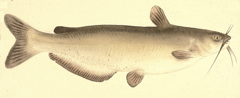
| Another important resource to the people of Arenosa was stone suitable for hot rock cooking and making tools. The favored cooking stone was limestone, which could be found most everywhere in one form or another -- angular clasts, slabs, and rounded stream cobbles were all used. The favored tool-making stone was chert (often called flint). The dominant rock formation of the area is the Devils River geological formation. It is a massive limestone containing abundant chert in the form of nodules, beds, or thin layers. The Buda Limestone and Del Rio Marl formations overlay the Devils River formation, but do not contain chert. The major drainages in the area, including the Pecos and Rio Grande river valleys, contain extensive gravel deposits that are composed primarily of limestone, but also include smaller amounts of chert and other lithic materials suitable for chipping and grinding. Within the river gravels, particularly those of the Rio Grande, are igneous and metamorphic rocks transported from hundreds of miles upstream.
|
|