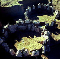
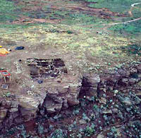
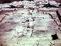
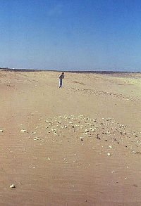
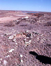
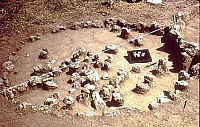
These two circular stone alignments
were partially exposed by riverbank erosion at the Chicken
Creek site within the Lake Meredith National Recreation
Area. Archeologists from the Bureau of Reclamation completely
exposed the patterns, which are thought to represent
the wall foundations of small structures, perhaps seasonal
field houses. The National Historic Preservation Act
of 1966 has given archeologists the opportunity to carry
out research at many small, unimposing Antelope Creek
sites that earlier archeologists overlooked. Photo by
Beverly Couzzourt, courtesy US Bureau of Reclamation.
Click images to enlarge
|
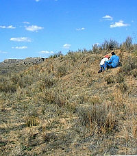
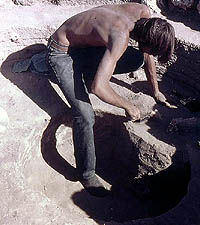
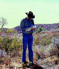
Landowner John Erickson and archeologist
Doug Boyd examine traces of a pit associated with a
Plains Village site. Excavations in 2004 revealed a
bowl-shaped barrow pit filled with household debris
including burned corn. Erickson's keen interest in the
ancient history of his ranch in northern Roberts County
has resulted in an ongoing research project involving
professional and avocational archeologists. Photo by
Steve Black.
|
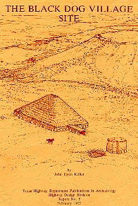
Cover of a report on the Black Dog
Village site. This project by the Texas Department of
Transportation was one of the first Antelope Creek excavations
undertaken because of the National Historic Preservation
Act of 1966.
|
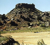
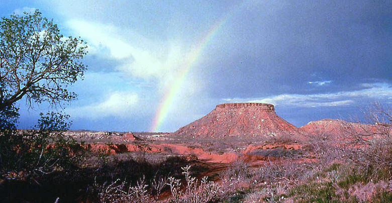
Mesa Alamosa is a smaller version of Landergin Mesa
some five miles to the east, and is sometimes called
“Little Landergin Mesa.” It, too, may
be a defensive retreat position used by Antelope Creek
villagers during periods when hostile raids were expected.
Mesa Alamosa was known to Studer and Hughes, but was
first formally recorded by Marmaduke and Whitsett
in 1973. Photo by Chris Lintz.
|
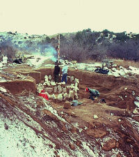
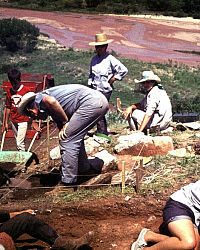
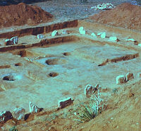
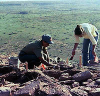
Excavations underway at the Chicken
Creek site in the winter of 1983 to salvage information
about this small Antelope Creek site before it was destroyed
by erosion. Photo courtesy U.S. Bureau of Reclamation.
|
|
One of the enduring
problems in archeology is that it is often very difficult
to find adequate funding for the final and, ironically,
most important part of any research project—the
hard work of thoroughly analyzing the recovered materials
and fully reporting the results.
Fortunately, most cultural resource management projects
include contractual requirements to fully complete the
archeological work. The resulting technical reports
that are part of what is often called the vast “gray”
literature. While such reports are not intended for
a public audience, they are an essential part of the
cultural resource management process.
|
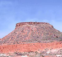
Archeologists perched atop Landergin
Mesa during the 1984 excavations sponsored by the Texas
Historical Commission. Photo courtesy Chris Lintz and
the Texas Historical Commission.
|
Aerial view of the 1984 excavations
underway at Landergin Mesa during work sponsored by
the Texas Historical Commission. Antelope Creek villagers
had retreated here in times of conflict. While the steep
walls flanking the mesa top once made the site easy
to defend, it also made archeological access a challenge.
Photo courtesy Chris Lintz.
|
The 1969 TAS field school investigated
several Antelope Creek sites along Blue Creek, a tributary
of the Canadian River, on National Park Service property
near Lake Meredith. Photo by Wallace Williams.
|
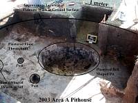
Pithouse excavated in August 2003
in the Buried City settlement zone by a field school
of the University of Oklahama. The work is part of Scott
Brosowske's dissertation research. Photo and graphic
by Brosowske.
|
Graduate Student Contributions
Graduate students have completed many
worthwhile studies on Plains Village topics related
to the Texas Panhandle. Here are some additional examples.
In the 1930s, E.J. Lowrey
and Tom Holden, two of Currie Holden’s
students from Texas Technical College completed graduate
theses on excavations at Antelope Creek 22, and the
pottery of Saddleback Ruins, respectively. More recent
contributions ... read
more>>
|
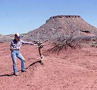
Archeologist Glenna Dean points to
the original base of a mesquite tree, which sticks up
some three feet above the modern ground surface near
Landergin Mesa. Long-term drought and overgrazing has
caused massive erosion during the last century in some
areas of the Texas Panhandle. Drought cycles plagued
the Plains villagers as well, although they did not
have to cope with overgrazing; in dry periods bison
moved elsewhere or died off. Photo by Chris Lintz.
|
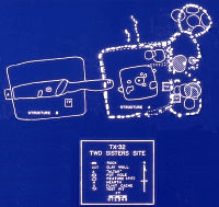
Plan map of two rectangular houses
at the Two Sisters homestead in the Oklahoma Panhandle
that are thought to represent successive occupations
by a single Plains Village family. The simple rockless
house on the left (Structure B) was succeeded by a more
elaborate house (Structure A) with a typical Antelope
Creek style stone slab foundation and smaller, attached
circular rooms. Graphic, courtesy Chris Lintz.
|
Structure B, the earliest of two
rectangular houses at the Two Sisters site, had most
of the architectural elements of a typical Antelope
Creek house, except the stone slab foundation. (Instead,
it probably had picket-post walls). Photo by Chris Lintz.
|
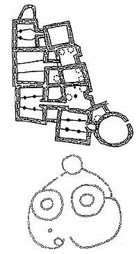
Antelope Creek vs. Apishapa
architecture. At top is the plan of main room
block at Alibates 28. The circular Apishapa pattern
is from the Cramer site in southeast Colorado. Both
are shown are roughly the same scale. Courtesy Chris
Lintz.
|
Chris Lintz excavating one of the
storage pits beneath Structure 5A at the Two Sisters
site in 1973.
|
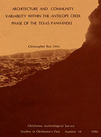
This 1986 report by Chris Lintz is
the published version of his 1984 University of Oklahoma
dissertation. It is one of the more useful studies of
Antelope Creek culture that has ever been done.
|
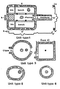
Lintz devised a detailed typology
of Antelope Creek structures and storage pits (collectively
termed architectural "units") to compare these
systematically from site to site. Lintz 1986, Figure
10. Click to see full graphic.
|
The Tucker Blowout site in the Oklahoma
Panhandle is a buffalo kill and butchering site that
dates to the fifteenth century. It is believed to be
the work of late Antelope Creek villagers or their immediate
descendants. Given the high frequency of buffalo bones
in many Antelope Creek villages, there must have been
many such butchering and kill sites. Photo by Chris
Lintz.
|
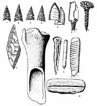
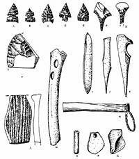
Antelope Creek phase artifact assemblage.
Click on image to see details. From
Lintz 1986, Figure 4.
|
Fragment of a charred basket found
on the floor of a burned Antelope Creek house. Antelope
Creek villagers were probably excellent basket makers,
but very few of their baskets survived. This one was
preserved only because it was intensely burned. PPHM
collections, photo by Steve Black.
|
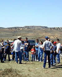
Doug Wilkens introduces a visiting
group of homeschooled kids and their parents to the
Indian Springs archeological site in Roberts County.
Wilkens is an active avocational archeologist as well
as one of the Texas Historical Commission's archeological
stewards. Dedicated volunteers continue to play a huge
role in Panhandle archeology. Photo by Steve Black.
|
|
Since the 1960s, archeologists studying the
Plains village sites of the Texas Panhandle and adjacent regions
of the Southern Plains have struggled mightily to make sense
of the variation that they and their predecessors have encountered.
We have come to realize that Antelope Creek culture was a
lot less uniform than earlier archeologists had believed.
As is invariably the case with ancient cultures, the more
we learn, the more we realize we still don't know.
Earlier archeologists were drawn to the larger
"villages," like Antelope Creek 22 and Alibates
28, that had visible structures arranged into pueblo-like
blocks of houses. These now appear to be the exception rather
than the rule. Even the larger Antelope Creek "villages"
would have been home to only a few dozen people and could
be more accurately called hamlets. These
paled in comparison to the truly large, fortified prehistoric
and historic villages in the Central and Northern Plains within
which hundreds of people lived. In contrast, most Antelope
Creek people seem to have lived in family groups in small
hamlets and even smaller farmsteads with
only one or two houses.
Instead of a single tribe or ethnic group of
closely related people, archeologists have found increasing
evidence that various Plains Village groups co-exisited in
different portions of the area we know today as the northern
Texas Panhandle. It is still likely that most of the core
area of the Antelope Creek culture along the Canadian River
valley north of Amarillo was home to villagers who were closely
related to one another, genetically and culturally. But not
so far away there were other peoples, such as those who lived
at Buried City, who probably belonged to different groups
or tribes and perhaps spoke different languages (or at least
different dialects). Increasingly, archeologists have found
evidence of competition and conflict among Plains villagers
and, perhaps, other less-settled peoples who found the villages/hamlets
to be tempting targets.
In this section we try to summarize the last
40 years or so of archeological research in the region, knowing
full well that there isn't any easy way to do this. Archeology
is a lot more complicated today and involves many more people
than it did in Floyd Studer's day.
CRM Archeology
Since the mid-1960s American archeology has
been transformed by the impact of federal and state laws intended
to protect cultural resources such as the National
Historic Preservation Act of 1966 and the Texas
Antiquities Code of 1969. These laws require that
archeological and historical sites on government land, and
on private land being developed or disturbed with federal
funding or by federal permit, be studied and evaluated before
adverse impacts are allowed to take place. If an important
archeological site lying in harm's way cannot be avoided and
protected, then research is carried out through excavation
or other means to preserve some of the information that makes
the site important, thus “mitigating” the loss
of information that the development will cause. One result
of these laws has been a tremendous increase in funding for
archeology and in the number of professional archeologists
employed by universities, government agencies, and, increasingly,
private industry. The industry that has developed because
of state and federal historic preservation laws is called
cultural resource management or CRM archeology.
Compared to many other areas of the country
and the state, the northern Texas Panhandle has seen only
a modest increase in the amount of professional archeological
research in recent decades. Most of the land remains in private
hands and population densities remain comparatively low in
most areas, hence federally or state regulated developments
are few. Nonetheless, cultural resource laws have led to new
research in the Antelope Creek area, especially on federally
owned lands in the general vicinity of Lake Meredith including
the Alibates Flint Quarries National Monument, the Pantex
Ammunitions Plant, and the Exell Helium Plant at the Cross
Bar Ranch. Although some excavations have taken place, efforts
to locate and evaluate archeological sites on federal lands
have resulted in a better understanding of the settlement
patterns of Antelope Creek villagers. Small hamlets and isolated
farmhouses were, we now know, much more common than the larger
pueblo-like ruins that attracted so much archeological and
public attention for so long.
In 1973, William Marmaduke
and Hayden Whitsett conducted an archaeological
reconnaissance in east Oldham County in the western part of
the Panhandle as a contribution to a “Natural Area Survey”
of the Canadian Breaks. This state-funded project recorded
49 archeological sites along Alamosa Creek and formally documented
Landergin Mesa and Little Landergin Mesa, both important Antelope
Creek sites. The resulting report highlighted the potential
of the region’s natural and cultural resources to be
protected and developed into regional attractions such as
state parks.
Federally funded highway work in the early 1970s
led to the excavation of part of the Black Dog Village
site, a large Antelope Creek settlement located at the confluence
of Cottonwood and Tarbox creeks with the Canadian River north
of Borger. Professional archeologists with the Texas Highway
Department excavated five structures there, aided by Jack
Hughes, Panhandle-Plains Historical Museum personnel, and volunteers
from the Panhandle Archeological Society. While a large Antelope
Creek structure dubbed the “Big House” attracted
much attention, two pairs of small rooms lacking typical Antelope
Creek house features were found that probably represent later
occupations.
During the 1970s, the U.S. Bureau of Reclamation
conducted a number of archeological surveys at Lake Meredith.
Archeologsits revisited the known sites and searched for unrecorded
sites around the lake in order to assess (and lessen) impacts
from public land use activities. Archeologists Meeks
Etchieson and Jim Couzzourt surveyed
the shore line during periods when the lake level was low
and recorded 53 sites, few of them known from the earlier
1961 survey. They also excavated slab-lined pits at two sites
and conducted flotation and radiocarbon dating on the contents
of these pits. Etchieson, a fulltime employee of the Bureau
of Reclamation, also conducted other small surveys and damage
assessments of tracts around the lake that were being impacted
by off-road vehicle traffic. This led to the “salvage”
excavation of several Antelope Creek houses. The results of
such work are documented in technical reports that are part
of what is often called the vast “gray” literature.
While such reports are not intended for a public audience,
they are an essential part of archeological research.
Etchieson was also instrumental in using archaeology
as a training program and involved the Youth Conservation
Corps in the testing and excavation of several sites at
Lake Meredith. These include the South Ridge site, the Ozier
site and a site on Plum Creek. The South Ridge site was used
during Antelope Creek times and earlier periods as well and
has been reported in full detail. The excavations at the two
other sites were supervised by Etchieson and other archeologists,
but have never been properly reported. It is difficult to
complete research during training programs such as these,
because they are geared chiefly toward excavation and preliminary
artifact processing, not full analysis and reporting. This,
of course, was the same problem faced by the WPA in the 1930s
and early 1940s.
In 1982-83, the National Park Service and the
Bureau of Reclamation funded two seasons of excavations at
the Chicken Creek site. Riverbank erosion
threatened this Antelope Creek site, where two small circular
structures were found. The fieldwork was directed by Beverly
Couzzourt, but the detailed results from only the
first season have been reported.
In 1990, all lands at Lake Meredith, except
some 700 acres of the dam axis and anchoring bluffs, were
transferred from the Bureau of Reclamation to the
National Park Service (NPS) jurisdiction. The changes
in federal responsibilities have sparked more interest in
surveys at Lake Meredith. Archeologists from the NPS Southwestern
Regional Office have carried out evaluative testing on several
Antelope Creek sites at Lake Meredith. Various private consulting
firms have completed site inventory surveys on about half
of the NPS property.
Some of the intensive surveys have been conducted
at the Alibates National Monument following
natural range fires. For instance, a study conducted by Paul
and Suzanna Katz under optimal surface
visibility identified numerous sites and quarry pits within
the monument boundaries. And other private and university
contractors have carried out surveys of the Bureau of Reclamation's
small property holdings adjacent to Sanford Dam.
Just upstream from Lake Meredith, jurisdiction
of the federal helium processing plant on the Cross
Bar Ranch switched from the Office of Surface Mining
to the Bureau of Land Management. Multiple archeological surveys
of the ranch have been conducted, including the development
of a predictive model of Antelope Creek site locations. These
surveys found that villages were often established near pour-off
plunge pools along secondary streams. These pool-side village
sites are often miles away from the Canadian River and must
have been linked to one another by trails.
Landergin Mesa
In 1981, Robert Mallouf, then
the State Archeologist of Texas, directed excavations at Landergin
Mesa for the Texas Historical Commission (THC). The work was
done to evaluate whether the site merited continued listing
as a National Historic Landmark. The THC
also sponsored additional excavations there in 1984 led by
Christopher Lintz. This mesa-top Antelope Creek village had
long attracted archeological attention because of its peculiar
defensive location—Landergin Mesa has no immediate water
source or nearby agricultural land.
Like many prominent Antelope Creek ruins, the
village atop the mesa had been badly disturbed by relic hunters.
Funding for the THC archeological work was pieced together
from federal, state, and private sources. Unfortunately, while
there was enough money for the fieldwork, laboratory stabilization
of records, photographs and specimens, and a few radiocarbon
dates, a full analysis and reporting has not yet been accomplished.
One of the enduring problems in archeology is that it is often
very difficult to find adequate funding for the final and,
ironically, most important part of any project—the hard
work of thoroughly analyzing the recovered materials and fully
reporting the results.
The THC investigations showed that, despite
extensive looting, substantial architecture and primary deposits
remained intact in some areas of the site. Landergin Mesa
was found to have had a long history of intermittent occupation
beginning in Late Archaic and Woodland times. Most of the
architecture (structural remains) dated to the Antelope Creek
phase, during which the half-acre mesa top saw remarkably
intense use. During the 1984 season, archeologists identified
ten structures from seven different occupations within a relatively
small excavation area covering 42 square meters (452 square
feet). One odd finding was that most of the houses seem to
have been built as isolated structures rather than the contiguous
rooms one might expect given the severely limited real estate
atop the mesa. The pattern of isolated-house construction
existed throughout the duration of the Antelope Creek phase.
Antelope Creek villagers apparently used Landergin Mesa as
a refuge in threatening times rather than as a permanent village.
A 2001 article by Lintz provides a useful summary of the excavated
features and details of the dating of the site.
Volunteers, Graduate Students, and Field Schools
Since the 1950s volunteers from archeological
groups and student “volunteers” from regional
universities have been involved in virtually all major excavations
of Plains village sites in the Texas and Oklahoma Panhandles.
The involvement of local archeological societies
has been mentioned in the previous section as has the pivotal
role played by Jack Hughes. In recent decades the Panhandle
Archeological Society (PAS) has charted a different
course from that taken by its predecessor group, the Norpan
Archeological Society. The Norpan group, like many local societies,
carried out many excavations on its own, few of which were
ever completely analyzed and reported. In contrast, the PAS
has focused on helping others and on publishing reports that
have long languished in obscurity. PAS members routinely volunteer
on field research projects run by professional archeologists
and other established groups. Even more importantly, the PAS
has published several other important archeological studies
in addition to the Baker's WPA reports and Earl Green's report
on the Footprint site.
Field schools organized by statewide groups,
the Texas Archeological Society (TAS), the
Oklahoma Anthropological Society, and by
various state universities have also been part of the story.
While field schools are held primarily to provide training,
important research can also be accomplished.
In 1969, the TAS held its eighth annual field
school along Blue Creek, a tributary of the
Canadian, on National Park Service property near Lake Meredith.
Jack Hughes directed the week-long investigations
of four Antelope Creek sites by over 200 volunteers from across
the state. Three of the sites were hamlets or small villages
while the fourth was a small cemetery where children and infants
were buried. While TAS field schools are positive learning
experiences, 200 people can move a lot of dirt in a week and
create small mountains of artifacts and field records. Hughes
never found time to study the Blue Creek finds. Fortunately,
two of his former students, Jim Couzzourt
and Beverly Schmidt-Couzzourt, took on the
project in the 1980s. Their detailed report finally appeared
in 1996, an accomplishment that few non-archeologists could
appreciate — successfully completing such a project
years after the fieldwork is finished is an extraordinarily
difficult feat.
The TAS field school returned to the northern
Panhandle in 1987 and 1988 as part of new investigations of
Buried City. This time it was Jack Hughes’
son, David Hughes, who directed the work.
David, who now teaches at Wichita State University (WSU) in
Kansas, led new work at Buried City on behalf of the Harold
Courson family beginning in 1985 and 1986. The 1987 and 1988
TAS field schools were even larger than the one at Blue Creek.
Hughes also ran a WSU field school at Buried City in 1990.
The results of the Buried City work are presented elsewhere
on this website (see Buried
City Investigations).
In 2000, Scott Brosowske of
the University of Oklahoma (OU) began investigating new areas
in the Buried City vicinity using remote sensing techniques.
In the summer of 2003, an OU field school excavated several
pithouse structures Brosowske located.
Brosowske is one of the latest of many graduate
students who have studied Plains Villager sites in the Texas
Panhandle and nearby areas. Dozens of students working on
advanced degrees or participating in specialized research
studies at universities in Texas, Oklahoma, Kansas, and elsewhere
have contributed to what we know about Antelope Creek culture.
As is the case in many fields of study, most of the master’s
theses and dissertations written by archeology graduate students
are never formally published. This is unfortunate, because
many such studies are in-depth analyses that have significant
research contributions.
Among those graduate students who have stuck
with it and gone on to complete dissertations and published
studies are four that deserve special mention: Lathel Duffield,
Marjorie Duncan, Robert Campbell, and Christopher Lintz. Their
contributions are highlighted below.
Antelope Creek Paleoecology
In the mid 1960s, two scientists from Wisconsin,
archeologist David A. Baerreis and climatologist
Reid A. Bryson, published a series of articles
advancing a fascinating hypothesis that, in part, might explain
the origin of Antelope Creek culture. Using climatic data
and newly obtained radiocarbon dates from Antelope Creek sites,
they argued that deteriorating climatic conditions in the
central Plains about A.D. 1200 had caused Upper Republican
peoples to move south from Nebraska to the Oklahoma and Texas
panhandles shortly thereafter. While a central Plains origin
for Antelope Creek had been postulated in the 1930s by Wedel
and reinforced by Krieger and then Watson, Baerreis and Bryson
were the first to provide a clear mechanism and supporting
evidence. Their work was the first time that Antelope Creek
paleoecology, the biological study of ancient organisms (humans
included) and their environment, had been seriously considered.
Inspired by this work, Lathel F. Duffield,
a graduate student under Baerreis at the University of Wisconsin,
decided to undertake a detailed analysis of the faunal materials
(animal bones) recovered from 11 Antelope Creek sites. Duffield
obtained collections from the three sites he had excavated
in 1962 at Sanford Reservoir as well as a series of other
sites including Antelope Creek 22, Alibates 28, and Sanford
Ruin. His 1970 dissertation remains a critical source of information
on Antelope Creek diet, hunting patterns, and paleoecology.
For instance, he identified 38 species of mammals, 29 birds,
8 reptiles, and 2 fish among the bones he studied, clearly
showing that Antelope Creek peoples relied on far more than
buffalo. To be sure, bison was the most important species
at all the sites he studied, but Duffield’s data suggested
that there had been a drying trend during Antelope Creek times
that by A.D. 1300 resulted in fewer bison and more antelope.
Was this trend a factor in the demise of Antelope Creek culture?
Recently, Majorie Duncan
has completed her dissertation at the University of Oklahoma
on a detailed ecological study of the animal bones from the
Two Sisters homestead site in the Oklahoma Panhandle. The
Two Sisters site is thought to be a small
homestead occupied by a single Plains Village family over
a lengthy period of time. Duncan’s study relies on contrasting
the bone assemblages from two superimposed houses occupied
between A.D. 1300 and 1450 that presumably represent continued
site occupation by successive generations. In addition to
providing a comprehensive description of the site and its
material assemblage, she documents the use of 15 species of
identifiable mammals, 10 species of reptiles, one amphibian
species, 15 bird species, three fish species, and one mussel
species. Based on ranking the importance of various prey and
studies of long-term resource depletion, Duncan presents a
fascinating model of how the site may have been abandoned.
She reasons that the work of acquiring food became too difficult
following environmental deterioration (increasingly
drier conditions) and the immediate area could no longer be
effectively farmed, forcing the family to move elsewhere for
survival.
Apishapa and Antelope Creek Phases
In the late 1960s Robert Campbell
completed his doctoral research at the University of Colorado
on the Chaquaqua Plateau of southeastern Colorado. There he
found evidence of a Plains village group who were responsible
for what he called the Apishapa phase. Apishapa
peoples built circular houses with stone foundations and Campbell
proposed they were the ancestors and originators of Antelope
Creek culture. He expanded this idea in his 1976 book, The
Panhandle Aspect of the Chaquaqua Plateau. Campbell argued
that around A.D. 1200, the Apishapa Plains villagers were
forced to migrate as the result of a prolonged drought. They
moved, he argued, south and east into the Canadian River valley,
bringing with them their knowledge of stone masonry. In the
Texas Panhandle, they came in contact with late Woodland peoples
who were already living in rectangular subterranean houses.
According to Campbell, the mix of cultures resulted in the
typical Antelope Creek houses with stone foundations.
Two years after the publication of Campbell's
book, his migration theory drew a withering critique from
a graduate student, Christopher R. Lintz.
In a 1978 paper called "Architecture and Radiocarbon
Dating of the Antelope Creek Focus: A Test of Campbell's Model,"
Lintz argued that his own appraisal of Antelope Creek radiocarbon
dates suggested that the Apishapa and Antelope Creek cultures
were contemporaneous rather than successive. (Today the issue
is being debated again -- see Hank's
House 2.)
Lintz, in essence, had taken up the task of
defining Antelope Creek culture where Alex Krieger left off
over three decades earlier. Lintz had been introduced to the
subject in the early 1970s as a young graduate student at
the University of Oklahoma (OU). He took part in two OU field
schools held at Plains Village sites in the Oklahoma Panhandle,
the first in 1972 at the McGrath site and
the second the following year at the Two Sisters site. Lintz
wrote up the McGrath site for his 1975 master’s degree.
His interest in the region grew in the 1970s and early 1980s
while he worked on various contract projects and continued
his graduate studies.
For his dissertation research, Lintz critically
reexamined many aspects of Antelope Creek culture, focusing
on the small core area centered on a 50-mile stretch of the
Canadian Valley north and northeast of Amarillo. Lintz had
two key advantages over Krieger. First, of course, he was
able to incorporate the results of three more decades of research,
a period during which radiocarbon dating had become an important
tool. Secondly, Lintz devoted a great deal more time to the
project than Krieger had been able to and was able to track
down many primary field records and unpublished manuscripts
as well as published accounts. His 1984 dissertation (formally
published in 1986) is a critical source on Antelope Creek
culture. Lintz has also published numerous articles and reports
on Antelope Creek sites and related research topics.
Lintz reaffirmed the validity of the Antelope
Creek concept, redefining it as the Antelope Creek
phase within what he called the Upper Canark
variant of the Plains Village tradition. Practically
speaking, the Upper Canark variant is a slightly expanded
version of what Krieger called the Panhandle aspect.
As you might expect, given the provincial nature of most archeological
research, the new variant name has found favor among Oklahoma
and Colorado archeologists. Equally unsurprising is the fact
that Texas archeologists rarely use the term, if for no other
reason than because of its awkward construction (Upper Canark
= upper drainage systems of the Canadian and Arkansas rivers).
Among Lintz’ contributions
are these five accomplishments: (1) he classified cultural
variation in Plains Village life across the western half of
the southern Plains; (2) he revised the chronology of Antelope
Creek; (3) he recognized that the extreme diversity others
had perceived in Antelope Creek architectural form represented
mainly variation on a relatively simple set of basic functional
forms; (4) he marshaled considerable data in support of plausible
explanations of the origin, development, social organization,
and demise of Antelope Creek culture; and (5) he offered an
improved explanation of the interaction between Antelope Creek
villagers and Pueblo peoples to the southwest.
Lintz compiled the available dating clues and
carefully reviewed the chronology of Antelope Creek and defined
two subphases, an early one (A.D. 1200-1350) and a late one
(A.D 1350-1500), thus pushing back Krieger’s dates by
over a century. Rejecting the Upper Republican origins postulated
by Baerreis and Bryson, Lintz embraced Jack Hughes’
argument that Antelope Creek was a local development that
had its origins in the area’s earlier Woodland and Late
Archaic cultures. (While the "local origins" hypothesis
is still considered viable today, it has yet to be supported
by solid evidence.)
The architectural variation long noted among
Antelope Creek and related Plains Village sites had befuddled
archeologists for decades. Lintz argued that many of the differences
were superficial and were attributable more to the availability
of building materials (or engineering constraints due to room
sizes) and, especially, to the failure of archeologists to
fully expose and understand Antelope Creek architecture. He
defined two dominant forms of basic residential units—houses—as
well as several types of “subordinate structures”
representing storage rooms, work rooms, cooking areas, and
other specialized-function areas.
At most Antelope Creek sites, particularly the
multi-room “pueblos,” subordinate structures outnumber
the actual houses and have caused some researchers to overestimate
the number of people who had lived there. The archeological
attention lavished on the so-called "pueblos" in
the 1920s-1940s created the false impression that these were
archetypical Antelope Creek "village" sites. In
fact, these appear to be exceptional sites that only occur
in a small area and they are are far outnumbered by smaller
sites with isolated or paired houses and subordinate structures.
Antelope Creek sites that have architectural
remains, Lintz said, could be divided into three categories:
hamlets, homesteads, and subhomesteads. (Some site types,
like rock art sites, butchering locales, and flint quarries,
do not have structures.) Even the largest sites, such as Antelope
Creek 22, were really not villages, but hamlets where
no more than eight families had lived. Homesteads
were smaller sites with one main house and various
subordinate structures where a single family had lived. Subhomesteads
were sites with subordinate structures but no main houses
and probably were seasonal farmsteads or other limited use
areas.
In early Antelope Creek times, most people lived
in hamlets, including the famed “pueblos” with
continuous rooms as well as the more common clusters of individual
houses and subordinate structures. But by late Antelope Creek
times, most people lived in homesteads, a change Lintz thought
was caused by increasing drought and the difficulty of finding
enough resources to sustain larger social groups. Another
early to late change was a statistically dramatic increase
in the amount of traded pottery and other items from the Rio
Grande Pueblos to the southwest. Greater trade and interaction
after A.D. 1300 was, he argued, a response to less predictable
climatic conditions for farming. In a subsequent study Lintz
also documented the unusual existence of true mound construction
at Alibates Ruin 28, where a mound at least four feet tall
with some kind of elevated structure atop was constructed
during late Antelope Creek times.
Sophisticated explanations of complex social phenomena,
like Antelope Creek life, are complicated and must take into
consideration many factors. Lintz did not simply make assertions
and offer "just-so" stories; instead he presented
supporting data ranging from radiocarbon dates, plant and
animal identifications, artifact counts, room size calculations,
feature distributions and so on. His comparative regional
analysis of hard evidence is exactly the sort of scientific
study that had been sorely lacking in Antelope Creek studies
for so long. Lintz’ work was a much-needed synthesis
and new interpretation of Antelope Creek life upon which other
researchers will be building (and picking apart) for many
more decades.
Recent Developments
It is hard to make proper sense of any recent
history simply because we are too close to the events and
personalities. In archeology, for instance, years and even
decades can go by between excavation and final publication
and between the productive career peaks of leading authorities
and their successors.
The small archeological community of the northern Texas Panhandle
is still in transition following the death of Jack Hughes
in 2001. Hughes left an unequaled legacy of students and friends
whose involvement in archeology he inspired. He also left
behind many systematic artifact collections and supporting
documentation from many Antelope Creek sites. As in many areas
of the state, much unglamorous work remains to be done to
tap the potential of these important collections.
Happily, there are positive developments underway. Government-sponsored
and government-mandated archeological research will continue
to provide new opportunities. Landowners such as Harold
Courson (Buried City), John Erickson
(northern Roberts County), and Pete Thurmond (Dempsey
Divide in western Oklahoma) are devoting their own time and
resources to learning more about the history of their land.
Veteran professional and avocational archeologists, many of
them Jack’s formers students, continue to be interested
in the archeology of the region, even those who have moved
away. For instance, Panhandle natives Doug Boyd
and Brett Cruise are professional archeologists
who have been returning to the region to help Erickson investigate
a little known area of the Canadian River Valley. Members
of the Panhandle Archeological Society, the TAS and the THC’s
stewardship network, such as Rolla Shaller,
Alvin Lynn, and Doug Wilkens
(among others), are involved in almost every field project
in the region. Graduate students from various universities
including the University of Oklahoma, Wichita State University,
the University of Texas at San Antonio, and Texas A&M,
are analyzing old Antelope Creek collections and undertaking
new research. Scott Brosowske’s work at Buried City
and other sites exemplifies the contributions that graduate
students are making. Finally, we note that Oklahoma professional
archeologists, such as Richard Drass and
Robert Brooks at OU, are studying Plains
Village and Woodland cultures in western and southern Oklahoma
that offer close comparisons with the villagers of the Texas
Panhandle.

|
| |
| Antelope Creek culture
was a lot less uniform and a lot more interesting than
earlier archeologists had believed. As is invariably the
case with ancient cultures, the more we learn, the more
we realize we still don't know. |
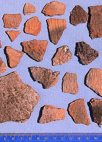
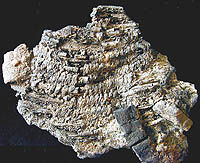
Borger Cordmarked pottery sherds
from the Congdon's Butte site in northeastern New Mexico,
one of the westernmost Antelope Creek sites. This earthenware
pottery provided basic household needs—storage
and cooking. The ruler at the bottom of the picture
is marked in centimeters. Photo by Chris Lintz. |
The “Big House” at the
Black Dog Village site is a large, classic Antelope
Creek house that is much larger than the other known
houses there. Archeologists from the Texas Highway Department
also exposed four, smaller rectangular structures that
are probably more typical houses and it is suspected
that numerous other rectangular and circular house patterns
may have been present elsewhere at the site, beyond
the highway right-of-way. |
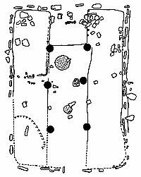
Plan map of the “Big House”
uncovered at the Black Dog Village site. This large
structure (18 by 26 feet) has many of the features identified
in classic Antelope Creek houses including a central
depression or “channel” flanked by slightly
raised benches and roof-support posts, central hearths,
partial slab wall construction, and an apparent “altar”
opposite the entranceway. Click to see full
image. |
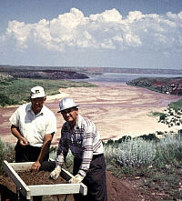
In the 1970s, Meeks Etchieson was
one of the most active government archeologists to be
stationed in the Texas Panhandle. Etchieson, who worked
for the U.S. Bureau of Reclamation, carried out surveys
and salvage excavations on federal land around Lake
Meredith. Photo by Chris Lintz. |
Archeologists have recorded numerous
partially exposed Antelope Creek houses on government
property surrounding Lake Meredith. This house, like
many, has been dug into by a treasure hunter. Such acts
are against the law on federal property. Photo by Chris
Lintz. |
| |
Archeologists expose the remains
of Antelope Creek houses that once stood atop Landergin
Mesa in 1984. Photo courtesy Chris Lintz. |
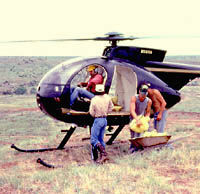
Archeologists get help hauling sterile
sand to the top of Landergin Mesa to stabilize and protect
the 1984 excavation block. Photo courtesy Chris Lintz.
|
The 1996 Bulletin of the Texas
Archeological Society features a final report by
Jim Couzzourt and Beverly Schmidt-Couzzourt on the 1969
TAS field school at Blue Creek. Few non-archeologists
can appreciate how difficult it is to successfully complete
such a project 15 years after the fact. |
TAS members pause while screening
excavated sediment during the 1969 TAS field school
at Blue Creek. In the background Lake Meredith is visible.
Photo by Wallace Williams |
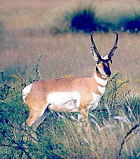
Pronghorn antelope appear to be better
adapted to drier conditions than bison. Lathel Duffield
used this observation to interpret the increased numbers
of antelope bones relative to bison bones in Antelope
Creek sites as a sign of worsening drought. Photo courtesy
Texas Parks and Wildlife. |
One of three circular rooms flanking
Structure A, the latest of two rectangular houses at
the Two Sisters site. The scattered rocks on the room
floor may have been used to weigh down a grass-thatched
roof. Beneath the floor were several large storage pits.
Photo by Chris Lintz. |

For his dissertation at the University
of Colorado, Robert Campbell studied Plains Village
sites in the Chaquaqua Plateau of southeastern Colorado.
These, he argued, represented an Apishapa phase that
he thought preceded the Antelope Creek phase. Campbell
later became a professor of anthropology at Texas Tech
University. |
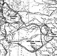
This 1989 map by Chris Lintz shows
the approximate territories of the Antelope Creek and
Apishapa phases as well as of the Buried City and Zimms
complexes. All are related Plains Village cultures that
coexisited around A.D. 1300. The dotted line is the
boundary of the Upper Canark variant, the name Lintz
gave to what earlier researchers called the "Panhandle
aspect." |
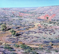
The picturesque valley of Antelope
Creek, namesake of the Antelope Creek focus, phase,
and culture. This photo was taken near Antelope Creek
Ruin 22, one of the culture's most impressive sites.
Photo by Chris Lintz |
| The Naming
Game What the reader may suspect
is true: we archeologists sometimes spend an inordinate
amount of time coining new names, arguing over definitions,
and otherwise splitting taxonomic hairs. We have our
reasons, but explaining these might put you to sleep.
Alas, it does make it hard for the non-specialist to
follow, especially when trying to compare articles or
reports written years apart. |
Apishapa phase artifact assemblage.
Click on image to see details. From
Lintz 1986, Figure 4. |
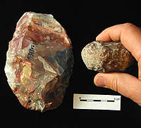
Antelope Creek villagers living at
Alibates Ruin 28 and other nearby villages (hamlets)
quarried the local material and made thousands and thousands
of tools for export/trade to other villagers and other
groups who lived elsewhere. Shown here is a large quarry
"blank" (unfinished biface) and a hammerstone.
PPHM collections, photo by Steve Black. |
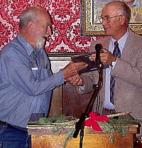
Jack Hughes (left) receives the Floyd
Studer Award for outstanding contributions to Panhandle
archeology from the Panhandle Archeological Society
in 1999. On the right is Alvin Lynn, then the president
of the PAS. Photo by Doug Boyd. |
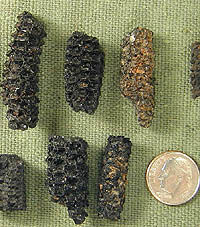
Charred corn cobs have been found
at many excavated Antelope Creek sites. Recent studies
have cast doubt on the extent to which villagers depended
on corn. Corn may have provided a relatively small part
of the diet. PPHM collections, photo by Steve Black. |
|