University of Texas at Austin wordmarkUniversity of Texas at AustinCollege of Liberal Arts wordmarkCollege of Liberal Arts
Texas Beyond History
TBH Home

Investigations and the Search for Cultural Patterns

Although considerable effort has been applied to understanding the cairn phenomena of west-central Texas, there is still little consensus among archeologists as to what they represent and who made them.  The great majority of excavations were conducted in the early years of Texas archeology, prior to the refinement of field methods and analytical techniques commonly used today.  Later cairn excavations were a fortuitous offshoot of federal government programs and state-sponsored river basin surveys conducted prior to impoundment of large reservoirs in the region. Other research has sought to correlate diagnostic materials from cairn burials with those from the few stratified (non-cairn) sites excavated in the region.

Here we consider what was learned in the past in light of more recent understandings of Texas cultural history.

Early Work

As early as the 1860s, cairn sites were probed for their contents. The U.S. Army dug into the stone features, particularly those along tributaries of the Colorado River, in hopes of gathering Native American skeletal remains (particularly crania) for examination and comparative studies at the Army Medical Museum. This work resulted in specimens removed for study with little regard to cultural context.  

After the turn of the century, cairn investigations were integrated into a broader quest to understand the region's past, with the list of investigators resembling a “Who’s Who” of early Texas archeology.  Beginning in the late 1920s, archeological pioneers E. B. “Ted” Sayles and Cyrus Ray began a remarkable series of archeological excursions along the Brazos River and its tributaries. Their decades of work resulted in excavations of at least 50 cairn burials and hundreds of non-cairn sites. Much of what we know about cairns today is due to their efforts.

An Abilene native, Sayles was a self-taught archeologist who combined love of the outdoors with an intense curiosity about the past. His passion sparked by finding artifacts “everywhere” in the archeologically rich region, he began to study archeology more seriously in the 1920s through correspondence courses from the University of Texas and by reading archeological reports. In 1932 he undertook a statewide reconnaissance of archeological sites in Texas under the auspices of the Gila Pueblo, a private foundation based in Globe, Arizona.  Sayle’s objective—enormous in its scale—was to compile sufficient site data to define cultures and trace relationships within the state and the larger southwest region. These efforts produced a prodigious amount of data and vast collections of artifacts.

Ray, an Abilene physician, had a keen interest in science and history that evolved into a decades-long quest to uncover ancient campsites, artifacts, and other remains left by the region’s early peoples. Together, the two friends founded the Texas Archeological and Paleontological Society (TASP) in 1928, and Ray became a prolific writer and editor for the organization’s bulletin, an annual journal.

In the Foreword to Volume 1 of that bulletin, Ray, then TASP president, recounts the circumstances leading to the founding of the society— an outgrowth of their Abilene-area excursions:

A little over two years ago, your president and secretary [Sayles] undertook the task of investigating the region near Abilene by utilizing week-end and holiday periods.  A little more than a year’s work revealed that the section surrounding Abilene had been inhabited not alone by the crude hunting tribes found in occupation of the country at the time of the conquest but by different tribes or peoples which had elaborated several distinct flint cultures.

Human bones and flints have been found at all levels from surface deposits to deposits stratified in hard clays…. So much was found in the limited time available that it was soon realized that such a large undertaking could better be carried out under the auspices of a scientific society.

The two men identified stone-covered burials in three general topographic locales:  1) within terrace deposits along watercourses; 2) within sandy post oak and mesquite belts; and, 3) perhaps most frequently, along high ridgelines and bluffs overlooking tributaries of the Brazos River. Sand dune and terrace burials frequently were found within or near extensive campsites containing hearths, tools, quantities of freshwater mussel shell, and other materials, while the high burials typically lay amid scatters of stone chipping debris and near chert outcrops.

Frequently the two men were guided to sites by area landowners who allowed them to survey their ranches.  All too frequently, however, Sayles and Ray found that cairn burial sites had been damaged or destroyed by relic collectors. 

As Ray wrote in the September 1932 TASP bulletin, “Many of the Indian Burial sites in this section have been destroyed either by readers of current treasure hunting fiction books who take their stories seriously or by arrow head collectors who imagine that every grave must be full of arrow heads.”  And, under the heading, “Scientific Values Destroyed,” he warns, “Considerable useless destruction of the flexed stone grave burials has been done by treasure hunters who ruthlessly destroyed the curiously shaped skeletons in a mad hunt after non-existent relics.”

Identifying Patterns

Although the elements of a cultural pattern in the Abilene area were recognized fairly early by Ray and Sayles, their basic findings were not adequately reported.  Ray’s articles in early bulletins of the Texas Archeological and Paleotological Society comprise the bulk of the published information about cairns, but his descriptions were mostly brief, often cryptic, and usually incomplete accounts. Nonetheless, some of his insights are important in trying to interpret these fast-disappearing cultural resources. 

After excavating a cairn and finding it apparently devoid of cultural content, Ray returned after a heavy rain to re-examine the feature. Turning over a large slab, previously unseen at the bottom of the pit, he found a small deposit of calcined bone fragments. “It appeared as though the bones had been burned almost to ash elsewhere and then put into some perishable container and buried under the rock,” he noted. Screening the deposit yielded three blackened human teeth, which identified it as a cremated human interment.

Wrestling with the wide variation he observed in cairn features, from simple stone-covered pits to elaborate slab-lined structures, Ray periodically attempted to synthesize his findings into general descriptions.  In a 1933 TASP article he wrote:

The covered stone slab cists offer many problems to the archeologist. Probably the term mound is a misnomer in the sense of anything of much consequence showing on the present soil surface. However, it is the writer’s opinion that in the long time ago when these structures were built that they were small mounds which accretion later covered completely with soil for some undetermined period. Now, only a few inches of the edges of a few of the stones are eroding from usually flat surfaces.  But when one excavates these he finds symmetrically built, usually round structures going down from three to four or more feet.”

As interesting as Ray's accounts may be, they were typically deliberately vague as to site locations, and findings from multiple sites often were jumbled together within the same article. In comparison, Sayles' accounts are more straight-forward and more readily comprehensible. Often accompanied by photographs, graphics, and sketch maps of sites, his records are more systematic, with locations of his finds consistently labeled according to Gila Pueblo survey designations. 

Prior to his comprehensive report prepared for the Texas survey, Sayles wrote a short report entitled Texas Burial Customs, which included brief descriptions of the Abilene area features. Never published, the manuscript is on file at TARL.  Several of the sites illustrated in the Explore the Sites section of this exhibit derive from these records and accompanying photos.

Both men devised chronologies and terms to help classify what they uncovered. Ray’s first attempt to characterize the burials of the Abilene area was encompassed within what he termed the “Sand Dune Culture.” Typically uncovered in plowed fields, sand-dune sites often were littered with camp debris, including an array of slender, thin arrow points—characterized by Ray as the "ultimate in artistic designs"—and other chipped-stone tools. At one notable sand dune camp site, Ray and Sayles collected hundreds of artifacts including dozens of projectile points. Among these were long-stemmed arrow points with finely serrated blade edges, triangular arrow points with multiple side notches, and numerous dart points. While these surface remains cannot be directly related to burials, they are nonetheless intriguing. The arrow point styles seem to have no clear correlates in other regions, but have notably been found within numerous cairn burials of west-central Texas.

With Sayles including sand dune sites within his “Brazos River Phase,” the two men recognized the confusion caused by using different terminology to describe essentially the same artifacts. Eventually they agreed on the term, “Brazos Culture,” to describe cultural remains within the latter part of the pre-pottery era in the region. Key markers for this culture included serrated arrow points, long, slender, "pine tree" shaped arrow points, long, slender side-notched arrow points, and double pointed knives, among other artifacts.

photo of pioneer archeologist E. B. Sayles with John Olgin
Pioneer archeologist E. B. Sayles (right) with assistant John Olgin, prepares to embark on a reconnaissance of Texas sites, Dec. 1931. TARL Archives. Enlarge image
photo of Cyrus Ray pointing to a gravel layer within deeply stratified river deposits
A nattily attired Cyrus Ray points to a gravel layer within deeply stratified river deposits near Abilene in this 1934 photo by E. B. Sayles, TARL Archives. Enlarge image
Image of the table of contents from the fFirst volume of the Bulletin of the Texas Archeological and Paleontological Society, 1929
First volume of the Bulletin of the Texas Archeological and Paleontological Society, 1929, containing articles by Cyrus Ray and E. B. Sayles on Abilene area cultures. A prolific writer, Ray served as bulletin editor for years. Enlarge image
 

Considerable useless destruction of the flexed stone grave burials has been done by treasure hunters who ruthlessly destroyed the curiously shaped skeletons in a mad hunt after non-existent relics.

Cyrus Ray-1932

Map and inset photo of a typical "Sand Dune" site Image map Image map
Map and inset photo of a typical "Sand Dune" site, with burial and camp area, recorded by E. B. Sayles. The exact location of this site is not known. Enlarge for detail of plan and inset. TARL Archives.
photo of examples of projectile points recovered from "Sand Dune" site
Examples of projectile points recovered from "Sand Dune" site, shown in map above. Note serrated edges on stemmed points, bottom row, and multiple side noteches on top row specimens. Photo by Laura Nightengale. E. B. Sayles Collections, TARL. Enlarge image
photo of a cairn burial site in Jones County, one of many discovered by Cyrus Ray in the 1920s and 1930s
A cairn burial site in Jones County, one of many discovered by Cyrus Ray in the 1920s and 1930s. TARL Archives. Enlarge image
photo of excavation at burial sites
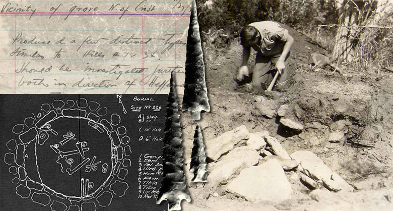
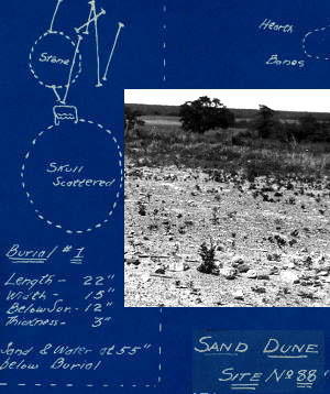
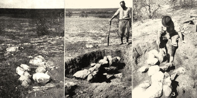
Excavation of burial number 3 at the Myatt site, Jones County: No. 1,Top layer of stones with earth removed; No. 2, Middle layer of stones, earth removed; No. 3, another view of middle layer of stones.  Below this layer, interred within a small circular pit about four feet below surface, were the closely flexed remains of a small adolescent, and within the skull was a single finger bone. In Ray's scenario, the body had been placed in the pit, then covered over with a stone structure, on top of which was placed "a great mass of heavy stones covering a large area in the center of the grave... ." Image from 1937 TASP article, “More Evidence Concerning Abilene Man,” by Cyrus Ray  (Plate 34).
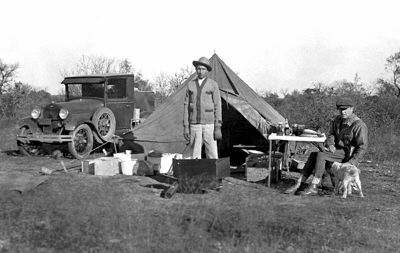
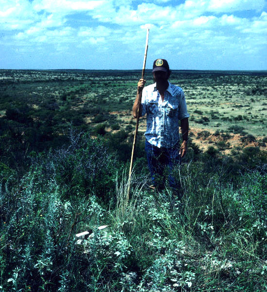
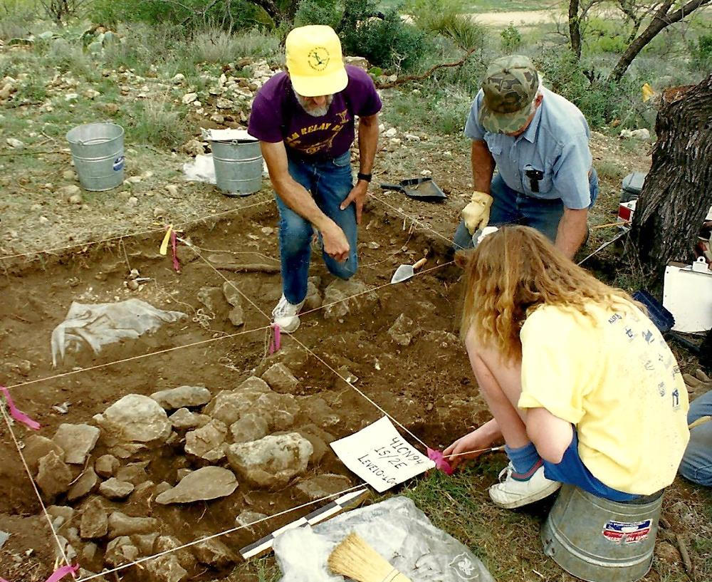
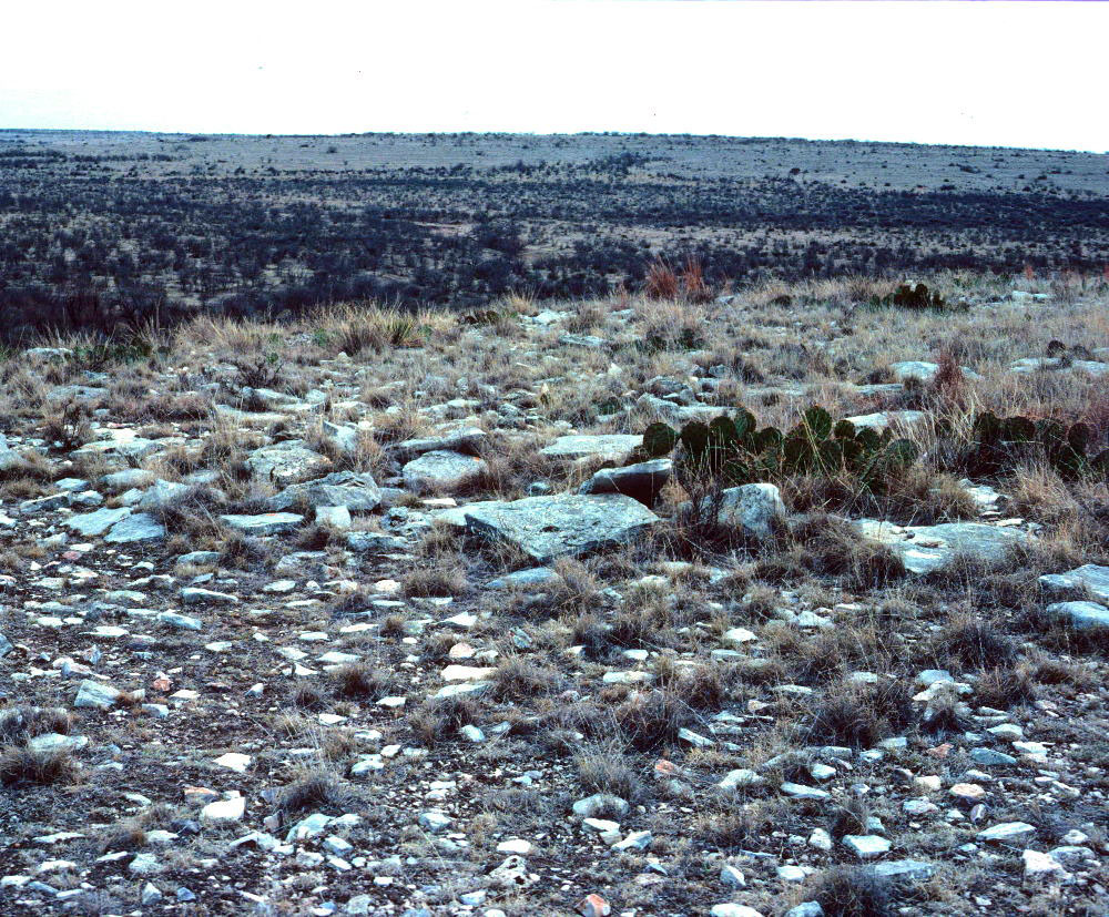
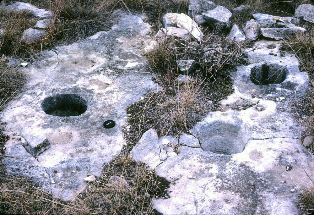
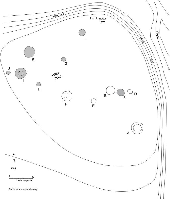
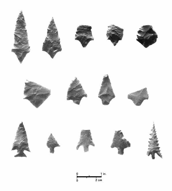
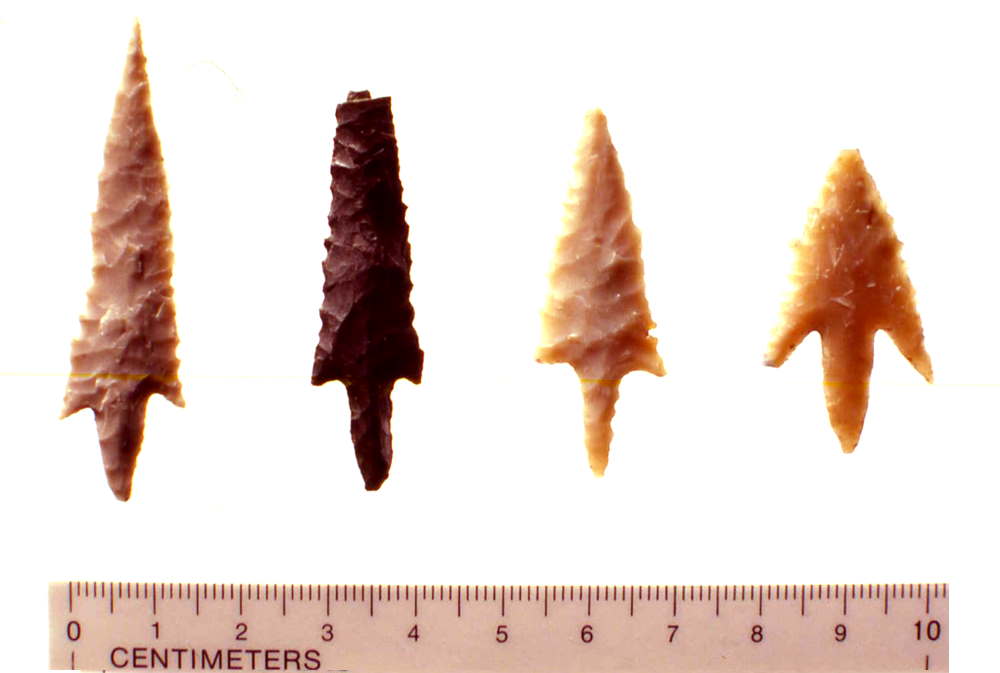
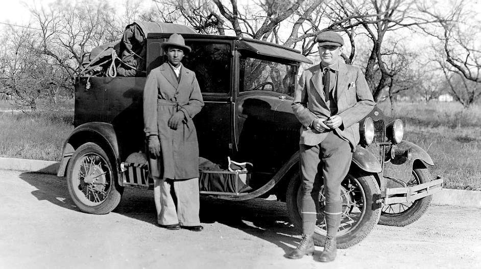
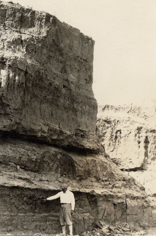
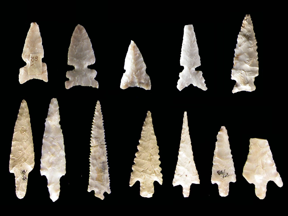
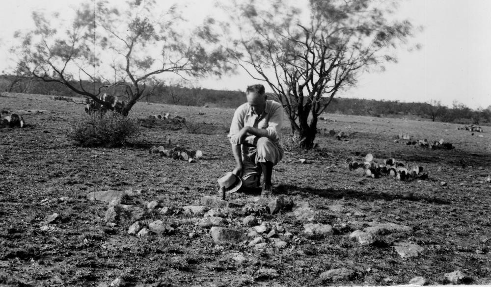
Later Investigations

From 1936 to 1941, the Works Progress Administration (WPA) designated funds for archeological excavations in Texas, resulting in a spate of more-systematic work in the Abilene area. As part of the Texas Technical College WPA archeological project, archeologist Joe Ben Wheat excavated numerous cairn burials in the Abilene area as well as a rare, stratified campsite, the Myatt site. Information from this site may have some bearing on the age of the cairn burial culture. Two of the distinctive arrow point types found in cairn burials were found in an occupational layer with a Late Archaic, Ensor-like dart point, and this stratum lay above one containing Zephyr-like dart points of the transitional Archaic period. These and other excavations are described only in unpublished WPA quarterly reports.

Some of Wheat's most significant work was conducted along an escarpment overlooking the Clear Fork, in some of the same areas investigated earlier by Ray. Distributed within a roughly two-mile area, sites 41JS1, 41JS73, 41JS122 constitute a series of cemeteries harboring the remains of at least 27 individuals. Based on the treatment of the bodies, including removal of skulls in some and mandibles in others, a number of people met a violent death. Stemmed arrow points with serrated blades were found within some of the graves. Further details on these and other sites can be found in the Explore the Sites section.

Additional archeological investigations in the region were carried out by University of Texas archeologists A. M. Woolsey and A. T. Jackson, largely responding to queries from area ranchers. Woolsey conducted excavations at two McCulloch County cairn sites which included both flexed and cremated remains (see Explore the Sites: 41MK26) and in Shackleford County (see 41SF1). Jackson worked alongside Ray in some excavations, and in a 1941 TASP bulletin article described a rock-covered burial on the tip of a narrow high ridge in Coke County in which the remains of three individuals were found along with two stone pendants and a conch shell gorget.

One of the most thorough and well-documented excavations of cairn burials was conducted by avocational archeologist Robert Forrester of Fort Worth at site 41SF18 in Shackleford County in the late 1930s. Situated on a terrace of the Salt Prong of the Brazos, the site contained the remains of 18 individuals, including two young men who presumably died of arrow wounds. Stemmed arrow points with serrated edges were found in the graves—including one point still embedded in bone—as well as an array of ornaments and other grave offerings.

Beginning in the 1950s, large-scale archeological surveys were conducted in the region prior to construction of reservoirs on the Colorado River, including O.H. Ivie (formerly known as Stacey Reservoir), Robert Lee, and Oak Creek. Covering thousands of acres, these surveys identified numerous prehistoric and historic period sites. Because of the sensitivity of buried human remains, concerted effort was made to identify cairn features, including a literature review for previously identified sites which might lie in the proposed reservoir basin.

Results of these efforts illustrate the challenge of cairn investigations. At O. H. Ivie, for example, archeologists determined that the great majority of cairn sites had been disturbed, if not destroyed by relic collectors, and thus were ineligible for further investigation.  Others lay outside the reservoir boundaries. Of 38 cairn sites previously reported, 29 were revisited by survey teams, and testing or full excavation was conducted on 18. Most were determined to be the foundations of historic structures or stacked stone markers denoting property boundaries. Only six of the stone features identified as cairns contained (or apparently once contained) prehistoric burials, and of these, only two, 41CN94 and 41CC237, contained intact burials. See Explore the Sites for more detail on these excavations.

Survey to the South

Archeologist and San Angelo native Darrell Creel has studied cairn sites for a number of years, conducting independent survey of private ranch land in Irion, Tom Green, Schleicher, Coke, Runnells, Nolan, and Concho counties as well as researching the records and collections of Sayles, Ray, and other investigators. His documentation of cairn sites provides information about distribution and patterning in the southern portion of the west-central Texas region, particularly along tributaries of the Colorado River, including the Middle Concho. During survey, he observed multiple, contiguous rock features—often numbering over 100— along bluffs and rocky slopes on both sides of minor draws. Many appeared to be in groups, with combinations of both very large (ca. 8 meters in diameter) and smaller features (ca. 4 meters). The most extensive clusters typically were situated along the tops of ridges.

Like those in the Brazos watershed, many cairn sites in the Colorado watershed were located near outcroppings of high-quality nodule chert which clearly had been utilized, based on abundance of tested cobbles and roughed-out bifaces.  At some sites, multiple circular and oval mortar holes had been worked into limestone ledges along nearby bluffs.

The sheer number and variety of cairn sites made documentation difficult. As Creel observed in his1980 field notes, “Some of the features which have been recorded as cairns may be natural, while some other small rock piles not recorded as cairns may be cultural. It simply is difficult to tell in some cases.”

Excavations at two of the cairns provided no answers. No clear internal structure could be detected nor was there evidence of cultural material, a situation perhaps analogous to the "blank," or empty, cairns encountered by Joe Ben Wheat during his excavations at 41JS122. As Creel noted, "Other than the symmetrical form and apparently non-natural accumulation of large slabs and small pebbles, there was no evidence for this being man-made."

Nonetheless, based on landowners’ accounts of human bone dug from cairn sites along the Middle Concho and the presence of burned bone still on the surface, many of the cairns are—or once were—graves.  Yet, their meaning is perplexing.

As Creel asked in his notes, “…how does one explain the occurrence of an estimated 150-200 [at least] burials so widely dispersed in an average small, west Texas draw?  Is this draw typical or is it a special place? The possibilities are many, and—if these are graves—very intriguing.”

Refining Frameworks: The Blowout Mountain Phase

Many insights have come from systematizing the records and collections of earlier researchers. Building on the earlier cultural designations by Sayles, Ray, and others, Creel proposed a new cultural framework to encompass specific cultural remains—including some of the cairn burials—dating to the early part of the Late Prehistoric period in the west-central Texas region. Termed the Blow Out Mountain phase, this designation pertains to the later part of the time period encompassed in Sayles’ and Ray’s Brazos River Culture designation.

Classifications such as these, while often overlapping and confusing, are important frameworks for ordering diverse information and constructing cultural histories. A phase refers to a pattern of archeological remains—a cultural expression—delimited both chronologically and spatially.  Said differently it refers to distinctive sets of artifacts and features relating to a particular time period and within a reasonably well bounded area. Frequently, there may be multiple phases encompassed within a larger period.

From a human behavioral standpoint, Texas archeologists refer to the Late Prehistoric period to mark two important changes in prehistoric technology: the introduction of the bow and arrow and the use of pottery. This period is typically broken into Late Prehistoric I (ca. A.D. 800-1200) and Late Prehistoric II (ca. A. D. 1100-1550).  The Blow Out Mountain phase represents a transitional, localized pattern dating to the time of the introduction of the bow and arrow in the region until the beginning of the Toyah phase of Late Prehistoric II. As we learn more about this cultural expression, the Blow Out Mountain phase may well be separable into shorter chronological intervals.

The specifics of the Blow Out Mountain phase were set forth in Creel’s 1990 report on a prehistoric campsite in Tom Green County (41TG91), one of the few deeply stratified sites excavated in west-central Texas. With layered deposits preserving evidence of repeated prehistoric occupations marked by time-diagnostic artifacts, such sites serve as critical reference points in establishing regional cultural histories. In the case of 41TG91, cultural materials were contained within 14 strata representing at least the last 2600 years, from Late Archaic to Historic Period times.

Notable artifacts and features of the Blow Out Mountain phase include distinctive  arrow point types, stone-lined hearths, flexed, cremated, or bundled burials in stone cists, and large quantities of mussel shell in campsites. Arrowpoints include two little-known stemmed types, Moran and Chadbourne, which appear to be limited almost exclusively to the west-central Texas region.  Moran points typically are exceptionally well made, with straight, often serrated blade edges, and long stems with straight to convex bases. The Chadbourne type is a triangular point with small shoulders and wide expanding stem with straight to concave base. Both types have been found in cairn burials. Scallorn-like arrow points with characteristic expanding stems also have been found in burials along with Moran points.

Large, well-made triangular bifaces also are characteristic of the Blow-Out Mountain phase. Notably lacking however, are the ceramics, end-scrapers, beveled knives and bison bones that are so numerous in the later Toyah phase sites. Based on faunal remains from 41TG91, occupants of the site during this time consumed deer, prairie dog, jackrabbit, cottontail, turtle, fish, river mussel, and other animals.

While site 41TG91 did not contain evidence of a cairn burial, skeletal remains (teeth and cranial fragments) of perhaps two individuals were found within disturbed contexts attributed largely to the Blow Out Mountain phase. Portions of the cranial materials had been charred, suggesting partial cremation. This unusual practice of burning only a portion of the corpse has been recognized frequently in cairn burials.

Clearly there is much more to be learned about cairn burials and the people who made them. We can form a very tentative picture of their lifeway based on evidence from the Blow Out Mountain component at 41TG91 which contained the same types of serrated, stemmed arrow points found in some cairn burials. To date, the area in which cairn burial features (and associated artifacts) have been most heavily reported is a 14-county area in west-central Texas apparently dating to the Late Prehistoric I period, but possibly beginning earlier. The limits of this cultural expression, both temporal and spatial, are still being defined.

photo of the camp at Mud Creek, Coleman County, Texas, Jan. 1, 1932
Camp at Mud Creek, Coleman County, Texas, Jan. 1, 1932." Shown are E. B. Sayles at table with assistant , Juan Olguin, and dog, Happy. TARL Archives. Enlarge image
photo of Wayne Chesser marking the location of a possible cairn on bluff edge at 41CC237
Archeologist Wayne Chesser marks the location of a possible cairn on bluff edge at 41CC237 during prelimary survey for the O. H. Ivie Reservoir by Prewitt and Associates, Inc. TARL Archives. Enlarge image
photo of members of the Concho Valley Archeological Society excavating a cairn burial at 41CN94
Members of the Concho Valley Archeological Society excavate a cairn burial at 41CN94, prior to impoundment of O. H. Ivie Reservoir. Photo by Larry Riemenschneider. TARL Archives.
photo of cairns along bluff edge, Irion County
Cairns along bluff edge, Irion County. Photo by Darrell Creel. Enlarge image
photo of bedrock mortar holes on ledge near cairn sites, Irion Count
Bedrock mortar holes on ledge near cairn sites, Irion County. Photo by Darrell Creel. Enlarge image
Sketch map of distribution of cairns and mortar holes on ridgetop site
Distribution of cairns and mortar holes on ridgetop site above a small tributary of the Middle Concho, Irion County. Adapted from field map by Darrell Creel. TARL Archives. Enlarge image
Image of the letter from Coke County landowner to Texas Archeological Research Laboratory regarding the numerous disturbed burial mounds
Letter from Coke County landowner to Texas Archeological Research Laboratory regarding the numerous disturbed burial mounds he had found in the county. Note reference to Deadman's point, a type similar to Moran, identified chiefly in the Caprock Canyonlands area to the northwest. Enlarge for detail. TARL Archives. Enlarge image
photo of arrow points from the Blow Out Mountain component at Site 41TG91
Arrow points from the Blow Out Mountain component at Site 41TG91 include long-stemmed serrated types (bottom row) which have also been found within cairn burials. The Scallorn point (bottom row, left) was found stratigraphically just above this component. Specimens on top two rows, once termed type Cliffton, are now considered to be unfinished arrow points, or preforms. Image from Creel 1990 (Plate 42). Enlarge image
photo of arrow points from the Blow Out Mountain component at Site 41TG91
Examples of Moran type points (shown at left and center) and Chadbourne. Moran typically is slender, and well made, and may have serrated blade edges; stems are narrow and parrallel to contracting in shape. Type Chadbourne is triangular and small shouldered, with a wide expanding stem and straight to concave base. Drawings from Turner and Hester 1999.
photo of Perdiz points, emblematic of the Late Prehistoric II period, were found in upper layers of Site TG91
Perdiz points, emblematic of the Late Prehistoric II period, were found in upper layers of Site TG91. There are no reported cairn burials with Perdiz points in west-central Texas, although several are known in the Trans-Pecos. TARL Archives. Enlarge image