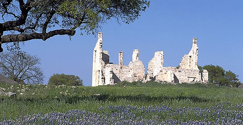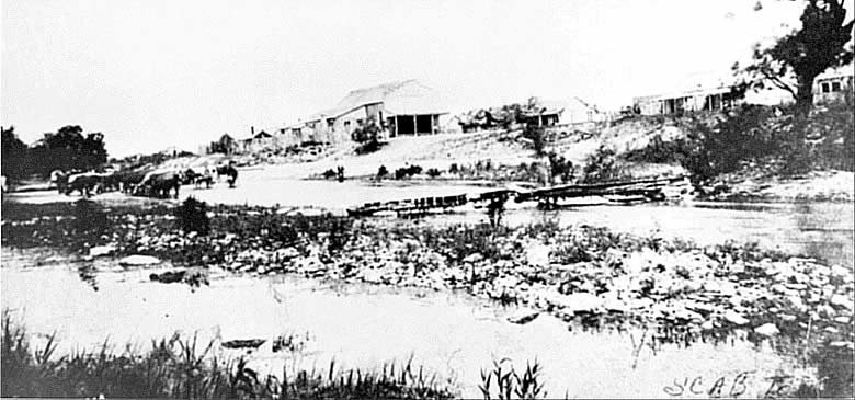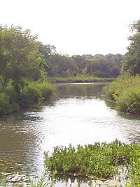
It's banks lined with pecan, oak, and black walnut trees,
the spring-fed San Saba river winds lazily through the
hill country, connecting the sites of the Spanish Colonial
mission and presidio to the nineteenth-century army post,
Fort McKavett.
Photo by Susan Dial.
Click images to enlarge
|
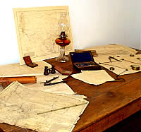
Tools of the surveyor. U. S. Army
engineers mapped routes across the state for travelers,
and placed garrisons in strategic locations to help
protect them. This selection of period surveying equipment
and maps is displayed at Fort Concho NHL, San Angelo.
|
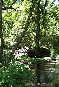
The clear waters of Government Springs
provided an ample water supply for the fort, then as
now. Photo by Susan Dial.
|
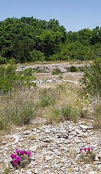
Amid brightly blooming cactus, limestone
cobbles—a hallmark of the Edwards Plateau—reflect
the sunlight. The white stone was quarried by soldiers
for building post structures. Quarry area is visible
in the distance. Photo by Susan Dial.
|
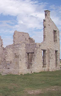
Built in 1856, the commanding officer's
quarters stands in ruin today. In addition to providing
residence for the commanding officer, his family, and
servants, it served as guest quarters for visiting officers,
including William T. Sherman, general of the army, and
Gen. Phillip Sheridan. Photo courtesy Texas Parks and
Wildlife Department. View
1936 photo of building before it burned. |
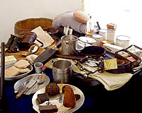
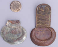
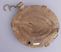
A cornucopia of supplies. A typical
officer's field pack weighed 76 pounds when full and
included "hard tack" biscuits, canned goods,
hunting knife, "mucket," and a cone of brown
sugar. John Cobb collection.
|
|
Although it was falling into ruin by the mid-1800s,
the abandoned Spanish presidio on the upper San Saba River
occupied a prominent place in the strategies of American soldiers
planning the defense of the Anglo-Texan frontier.
Albert Sidney Johnston, secretary of war of
the Republic of Texas, had proposed placing a garrison at
the "old Spanish fort" as part of his plan for a
line of military posts running from the Red River to the Nueces.
Texas never implemented Johnston's plan, but officers of the
United States Army would later look favorably on the presidio's
central location on the Edwards Plateau.
The end of the United States' war with Mexico
in 1848 brought two issues of military strategy to convergence
in the Hill Country. The first was the protection of the frontier
settlements from raids by Comanche and Kiowa Indians. The
second was the protection of westering travelers headed for
the gold fields of California by way of El Paso.
The discovery of gold in California set off
a flurry of exploration for transcontinental travel routes.
Overland passage from St. Louis required crossing the uninhabited
Great Plains—or Great American Desert, as the region
was denominated on maps of the time—with their twin dangers
of Indian attack and winter blizzards. The sea route, around
the southern tip of South America, looked on paper to be even
more time-consuming than it was in practice, and was expensive
in any event.
Travel from New Orleans to Austin or San Antonio
seemed easy enough. Passage from there, through El Paso to
southern California, would be free of snow. The only thing
lacking was development of a route that was safe from hostile
Indians.
The veteran ranger and surveyor Jack Hays conducted
an ill-fated exploration west from San Antonio in 1848 that
was followed the next year by the more successful venture
of Hays' fellow ranger, John S. "Rip" Ford, and
U.S. Indian agent Robert Neighbors. Their effort began north
of Austin and proceeded west, following the Concho River from
its confluence with the Colorado, into the Trans-Pecos region,
then west to El Paso. The Ford-Neighbors expedition returned
by way of the Concho, San Saba, and Llano rivers, then through
Fredericksburg and into San Antonio.
The U.S. Army was following the same train
of thought, and almost the same schedule, as the civilian
explorers. Departing San Antonio, lieutenants W.H.C. Whiting
and William F. Smith traveled through Fredericksburg to the
San Saba River, then west through the Trans-Pecos. When they
returned, Whiting recommended locating a garrison of mounted
troops at "old Fort San Saba." In 1851, Brevet Major
General Persifor Smith, commanding U.S. Army forces in Texas,
ordered the construction of a post on the San Saba "at
the headsprings of that river near the El Paso road."
Selection of an 8th Infantry headquarters on
the San Saba proved unsatisfactory. The regiment arrived at
the headwaters in March, 1852, and established camp as ordered.
The site was on a small hill near a pond of "permanent"
water. Although construction was begun on a lime kiln and
bakery, the camp was soon moved two miles downstream when
the pond became stagnant.
The new location was at first referred to as
the "Camp on the San Saba" or "Post on the
San Saba." In October, it was renamed Camp McKavett—and
thereafter Fort McKavett—in honor of Captain Henry McKavett
of the 8th Infantry, who had served meritoriously in the Mexican
War and been killed at Monterrey in 1846.
Five companies of the 8th Infantry initially
were assigned to the post, and they set about constructing
permanent buildings: five infantrymen's barracks, kitchens
used temporarily as officers quarters, a hospital, and a quartermaster's
storehouse. These were erected around a square parade ground.
Each company was responsible for constructing its own quarters,
and those of its officers.
Limestone was quarried nearby for building
foundations and walls, and was burned—probably in the
kiln at the original location—for mortar. Oak and pecan
logs were used for construction of some buildings in the jacal,
or picket, style. At first, there was no lumber for floors
or doors, nor glass for windows. The required materials were
transported from Fredericksburg in later years.
The post was improved substantially through
the mid-1850s. The new construction included two-story quarters
for the commanding officer and one-story barracks for other
officers, adjutant's office, guardhouse, new bakery and kitchens,
and laundresses' quarters.
Military operations at and around Fort McKavett
reflected the evolution of the army's strategy of frontier
defense in the 1850s. On an inspection tour in August, 1853,
Colonel W. G. Freeman found Fort McKavett garrisoned by one
company of mounted infantry—46 men with only 30 serviceable
horses, "wretchedly equipped." The company's request
for needed equipment had been properly rejected, said Colonel
Freeman, because, "it is now everywhere conceded that
the experiment of mounting infantry has not been successful."
|
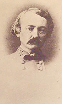
Lt. W. H. C. Whiting of the U.S. Army Corps of Engineers, along with Lt. William F. Smith, surveyed the route for the "lower
road"for emigrants traveling from San Antonio to
El Paso and on to the gold fields of California. To protect
those traversing the" upper road" through Fredericksburg,
he recommended locating a garrison of mounted troops on
the San Saba river.
|
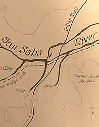
The proposed location for the fort indicates its strategic
location near an Indian trail as well as the upper road
to San Antonio, marked on the map as Lt. Whiting's route.
Map courtesy Texas Parks and Wildlife Department. |
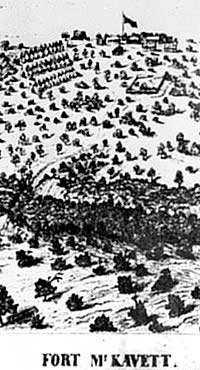
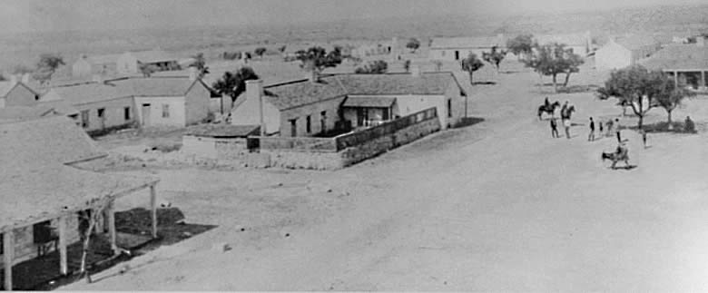
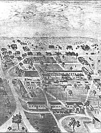
Sketch of Fort McKavett, with river winding below, circa
1861. Image courtesy Texas Parks and Wildlife Department.
|
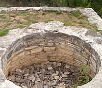
Kiln to make lime, used in plaster for the buildings as
well as in privies at the fort. Limestone rock was placed
in the kiln and heated from a wood fire below. The three-
to four- day reduction process included burning, cooling
and slaking the material before the powdery lime was ready
for use. Photo by Susan Dial. |
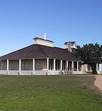
The second post hospital, completed in 1874, replaced
a smaller structure from the 1850s. The new structure,
set well apart from other buildings at the fort to curtail
windborne germs and odors, housed the offices of the surgeon
as well as a wing for patients. The building to left is
the dead house, or morgue. Photo by Steve Dial. |
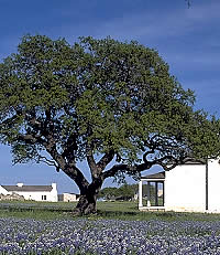
The post schoolhouse (on right) was
constructed in 1874 to provide an education for enlisted
men, particularly the freed slaves who enlisted in the
Army after the Civil War. Taught frequently by the post
chaplain, the men learned to read and write in classes
at the end of the work day. On left are lieutenants'
quarters.
|
|
