Jacques Nicolas Bellin 1764
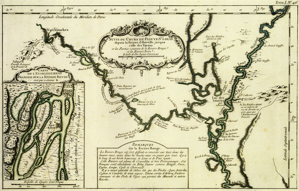 Full Map
Suite de Cours de Fleuve St. Louis |
|
Detailed and attractive map by the leading French hydrographic cartographer of the mid-18th century showing the lower Red River and the upper part of the lower Mississippi valley. The map shows Los Adaes (Adayes), which is depicted on a hill top. The inset shows an enlarged detail of the French settlement of Natchitoches. Translation of part of the map's inscription: |
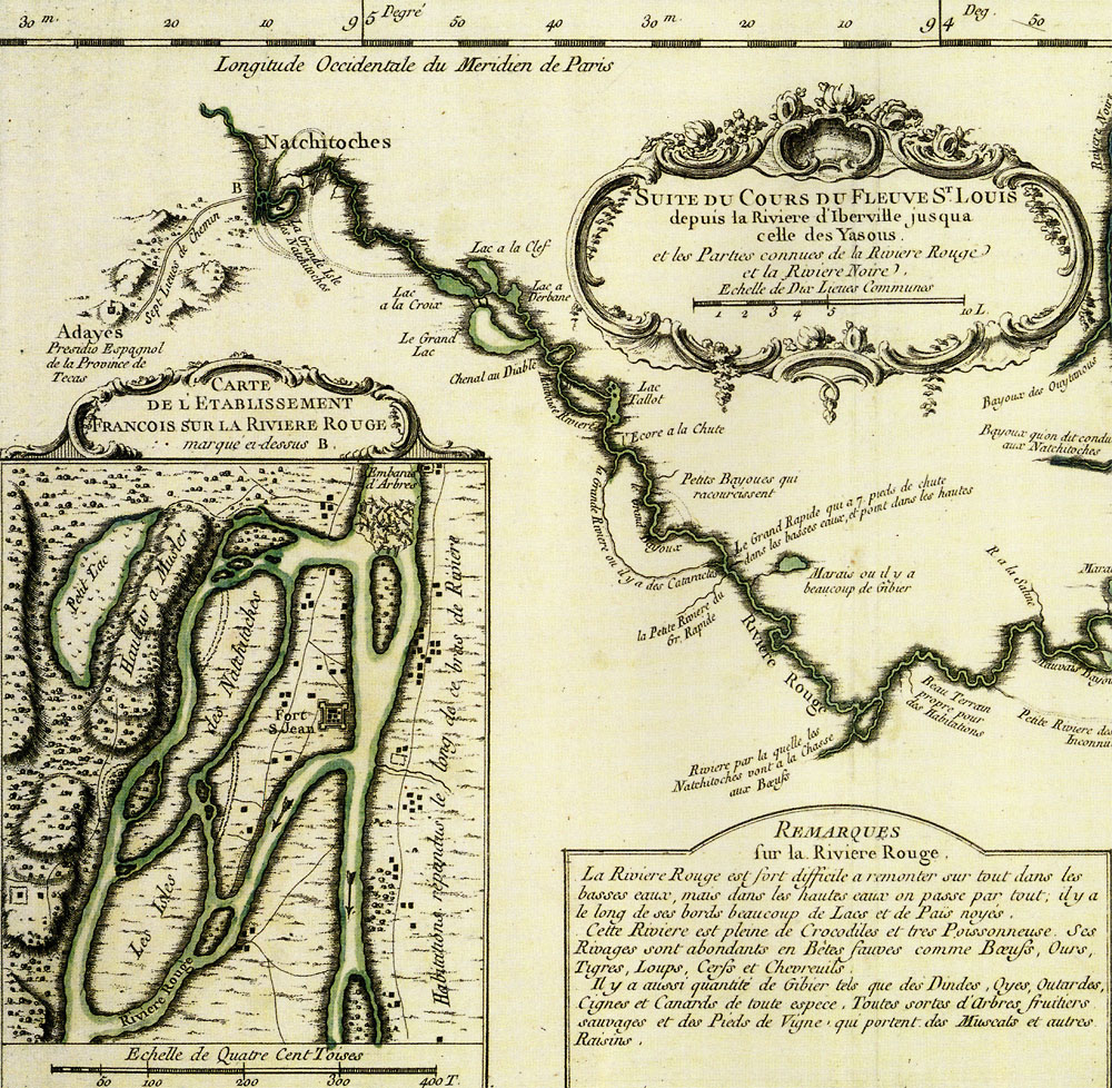 Map Detail |
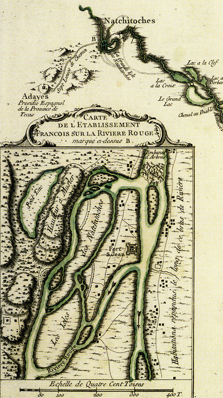 Map Detail 2X |