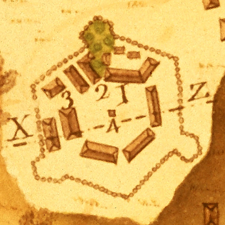
The Urrutia map shows how the presidio actually appeared in 1767. While frontier realities resulted in simplification and compromise, the basic outline and layout remains faithful to the 1720 plan.
1- Governor's House
2- Chapel
3- Guard House
4- Powder House
The other long rectangular buildings are soldiers barracks. The X-Z dashed line shows the axis of the profile drawing.
|

