The cultural landscape of the Ware and Hendrick plantations includes the core parts of each as loci of residential activities, the two plantations as immediate neighbors, and their connections to more-distant neighbors and commercial centers through a network of roads and trails. Historic-period maps were critical to reconstructing this cultural landscape, particularly the 1863 map used here.
This interactive map shows important places in northeast Rusk County that were part of the daily lives of the plantation occupants. Click on the colored features and text to read about these places and see related photographs and newspaper clippings.
Cultural Landscape Approach
The Hendrick and Ware plantations were studied as elements of a cultural landscape rather than as discrete sites. A cultural landscape approach takes into consideration how natural and human-made systems link a place to its wider ecological and cultural environments. Examples of natural systems include hydrology, topography, geology, flora and fauna, and climate. Human-made systems can include roads and trails, nearby communities, technologies, and raw materials and manufactured goods available during the period of interest, in this case, the mid-nineteenth century.
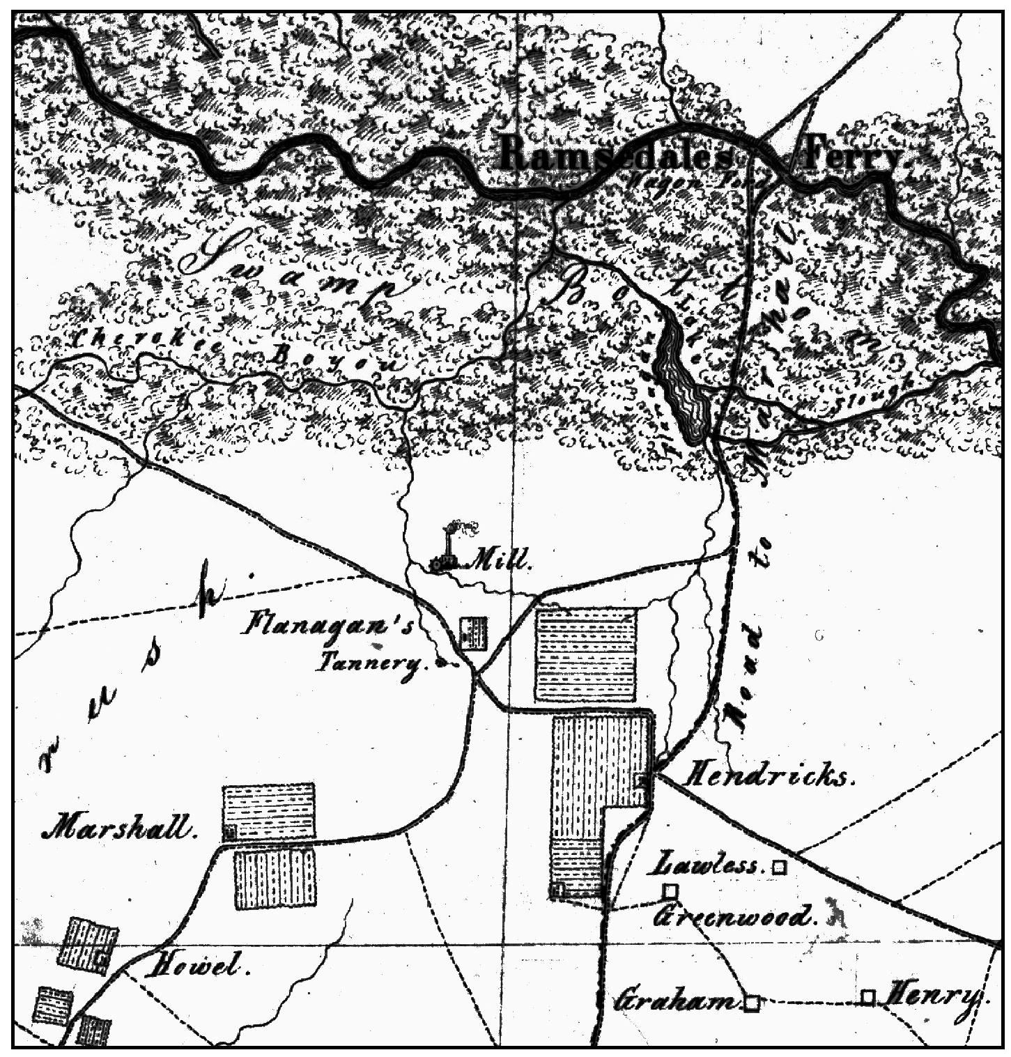
The interactive map above and the unaltered detail to the right are excerpted from the 1863 von Rosenberg map, an important map for reconstructing the cultural landscape of the local area. Wilhelm “William” von Rosenberg, who previously was the chief draftsman for the Texas General Land Office, created the map as a reconnaissance effort in his role as topographical engineer and captain in the Confederate Army. In the map detail, the Hendrick plantation core is marked on the lower right quadrant. By the time this map was drawn, Levi Hill Ware was deceased and his widow was remarried to James Flanagan, whose tannery is marked near the map center at the location of the Ware Plantation.
Additional details of the cultural landscape of the study area are conveyed in this exhibit's 1863 Visit.